
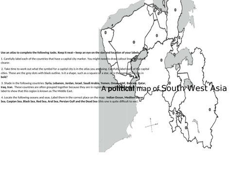
A lesson examining the political geography of the Middle East. Pupils use maps and atlases to develop locational knowledge. The second page of the map included in this resources is related to Lesson 2 in this unit. The worksheet is not poorly formatted, by the way - TES Resources has jumbled the photo but the worksheet is as it should be, a correctly formatted Word document.
This is a part of a fully-resourced unit with a range of styles of activity and unashamedly embracing aspects of thinking skills (they still work) and dual coding. The unit was designed for Y9 and synoptically revises their KS3 course whilst using skills and concepts from their KS4 Geography studies (specifically, for Eduqas Geography B but relevant to all boards).
Get this resource as part of a bundle and save up to 15%
A bundle is a package of resources grouped together to teach a particular topic, or a series of lessons, in one place.
Something went wrong, please try again later.
This resource hasn't been reviewed yet
To ensure quality for our reviews, only customers who have purchased this resource can review it
Report this resourceto let us know if it violates our terms and conditions.
Our customer service team will review your report and will be in touch.
£3.75