


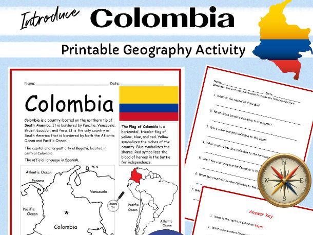
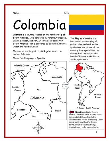
Introduce your students to the country of Colombia in South America with two printable worksheets (plus answer key). Simple map activity and reading comprehension questions. Includes continent, location, capital city, flag, language. Students can use the compass to answer questions on page 2.
Your students will read a brief introduction to Colombia (location, capital, language, flag), write Bogotá next to the star on the map to show the location of the capital, color the map, and use the map and compass to answer (7) questions on page 2. Colored pencils and a pen or pencil are needed for this activity. No other prep needed. Basic Geography worksheet with a simple map to introduce Colombia and practice cardinal and ordinal directions.
Please note: This resource is also included in the Countries of South America Printable Worksheets Bundle! Link: https://www.tes.com/teaching-resource/countries-and-capitals-of-south-america-11820933
For use with Interactive Notebooks: After the worksheets are completed, students can cut out the map and flag and paste into the notebook under the topic of Countries of South America / Sub-topic: Colombia. Under the map, they can write a summary in their own words of what they now know about this country. Collect handouts for other countries of South America to add to the notebook!
Link to South America Countries Bundle: https://www.tes.com/teaching-resource/countries-and-capitals-of-south-america-11820933
Thank you so much for using my Geography worksheets in your classroom. I hope you find them useful. Please browse this store for more printable activities with simple maps to introduce your learners to the countries of the world!
Your students will read a brief introduction to Colombia (location, capital, language, flag), write Bogotá next to the star on the map to show the location of the capital, color the map, and use the map and compass to answer (7) questions on page 2. Colored pencils and a pen or pencil are needed for this activity. No other prep needed. Basic Geography worksheet with a simple map to introduce Colombia and practice cardinal and ordinal directions.
Please note: This resource is also included in the Countries of South America Printable Worksheets Bundle! Link: https://www.tes.com/teaching-resource/countries-and-capitals-of-south-america-11820933
For use with Interactive Notebooks: After the worksheets are completed, students can cut out the map and flag and paste into the notebook under the topic of Countries of South America / Sub-topic: Colombia. Under the map, they can write a summary in their own words of what they now know about this country. Collect handouts for other countries of South America to add to the notebook!
Link to South America Countries Bundle: https://www.tes.com/teaching-resource/countries-and-capitals-of-south-america-11820933
Thank you so much for using my Geography worksheets in your classroom. I hope you find them useful. Please browse this store for more printable activities with simple maps to introduce your learners to the countries of the world!
Get this resource as part of a bundle and save up to 62%
A bundle is a package of resources grouped together to teach a particular topic, or a series of lessons, in one place.
Bundle
Spanish-Speaking Countries
This bundle includes printable handouts for each Spanish-speaking country. For each country, your student will read a brief overview of that country (location, capital, flag), write the capital next to the star on the map, color the flag and small map of the country and surrounding areas, and use the map and compass to answer questions. Handouts for countries include: Argentina, Bolivia, Chile, Colombia, Costa Rica, Dominican Republic, Ecuador, El Salvador, Guatemala, Honduras, Mexico, Nicaragua, Panama, Paraguay, Peru, Spain, Uruguay and Venezuela.
$14.99
Bundle
SOUTH AMERICA - Printable handouts for each country of South America
Introduce your learners to South America one country at a time with a printable activity for each country!<br /> <br /> For each country of South America, your students will read a brief introduction (location, capital city, flag, language), write the capital next to the star on the map, color the small map and flag, and use the map and compass to answer questions and identify the locations of surrounding countries. <br /> <br /> Printable handouts for countries of South America include: Argentina, Bolivia, Brazil, Chile, Colombia, Ecuador, Guyana, Paraguay, Peru, Suriname, Uruguay, Venezuela, and French Guiana. <br /> <br /> Colored pencils and a pen or pencil are needed for this activity. <br /> <br /> Also included in this bundle: <br /> <br /> South America List of Countries and Capitals, Fill in the Blanks, Word Search. <br /> <br /> For use with Interactive Notebooks: After your students complete the worksheets for a country, they can cut out the map and flag and paste into the notebook under the topic of Countries of South America / Sub-Topic (country). Under the map and flag, they can write a summary about what they now know about that country. Add each country of South America until unit is complete!<br /> <br /> Thank you for using my Geography worksheets in your classroom. I hope you find them useful! Please browse this store for more printable worksheets with simple maps to introduce your students to the countries of the world!
$11.99
Something went wrong, please try again later.
This resource hasn't been reviewed yet
To ensure quality for our reviews, only customers who have purchased this resource can review it
Report this resourceto let us know if it violates our terms and conditions.
Our customer service team will review your report and will be in touch.
$1.99