
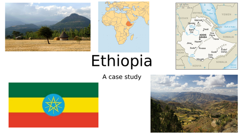
Firstly, the students are asked to use an atlas to locate a range of features into an outline map of Ethiopia. They are then asked to describe the location of Ethiopia. After that they are asked to use the atlases to create a fact file about Ethiopia. Next they are asked to interpret and describe a climate graph of Ethiopia. Then the students are introduced to the landscape, using photos to show the different physical features. They can locate this information on a map. After that the students are asked to identify the different ecosystems of Ethiopia. They could undertake map comparison to explain why different ecosystems occur in certain areas. All resources are included at the end of the PowerPoint.
Get this resource as part of a bundle and save up to 64%
A bundle is a package of resources grouped together to teach a particular topic, or a series of lessons, in one place.
Something went wrong, please try again later.
This resource hasn't been reviewed yet
To ensure quality for our reviews, only customers who have purchased this resource can review it
Report this resourceto let us know if it violates our terms and conditions.
Our customer service team will review your report and will be in touch.
£2.00