
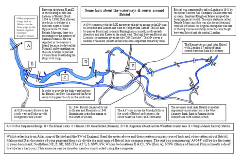
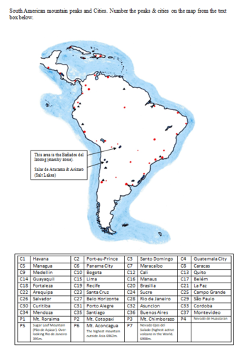
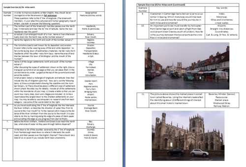
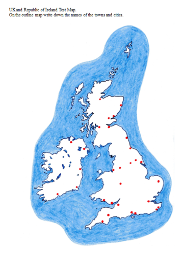

A 268 page document with over 50 outline maps from around the World. This resource book is to be used in conjunction with a school atlas. There are a multitude of exercises and challenges for students to use as homework or in the classroom with or without guidance from the teacher. Also included, there are over 180 photographs from the UK and around the World that can be used individually for lesson starters or as topic slide shows.This resource work book can be used with a wide range of age groups. The outline maps and questions are suitable for children between the age of 9 to 16 years. The content has a wide degree of differentiation for more and less able children. The many pictures included in this document are ideal as introductions to new topics. Although the main focus of this resource is on Geography, much of the content can be linked to, Travel and Tourism, History, English and Social Studies. Special featured sections: China, London, Spain, Bristol and WW1 Flanders. All income from this resource will be donated to 3 Homeless Charities in 2021 . The Salvation Army, Crisis and The Berwick Project.
Something went wrong, please try again later.
Thank you for sharing your resource. This resource has been recommended for teachers by the TES Resource Team.
Report this resourceto let us know if it violates our terms and conditions.
Our customer service team will review your report and will be in touch.
$4.00