Hero image

IanPCostaDelSol-Shop

Average Rating4.73
(based on 24 reviews)

My shop is a non profit making concern & it supports homeless charities (Crisis, The Salvation Army & The Berwick Youth Project). Teaching has been my life & I continue to support learning around the World. My subjects were: History, Geography and Physical Education. I have competed in a wide variety of sports inc.: Gymnastics, Badminton, Rugby, Football, Athletics & many others. Check out my recent bundle with 11 of my best publications. A vast amount of support material on offer.

86Uploads

49k+Views

29k+Downloads

My shop is a non profit making concern & it supports homeless charities (Crisis, The Salvation Army & The Berwick Youth Project). Teaching has been my life & I continue to support learning around the World. My subjects were: History, Geography and Physical Education. I have competed in a wide variety of sports inc.: Gymnastics, Badminton, Rugby, Football, Athletics & many others. Check out my recent bundle with 11 of my best publications. A vast amount of support material on offer.
Mapwork Skills - Home Studies 2020
IanPCostaDelSolIanPCostaDelSol

Mapwork Skills - Home Studies 2020

(0)
Home Study 2021. Improve your map skills at home. All income from this resource goes to homeless charities during 2021. Map Skills - 50 page document with exercises and maps that can be photo-copied and re-used in different ways. Best suited to children between the ages of 10 and 14 (May be useful for Key Stage 4 revision work on map skills). All text, maps, photographs, sketches and graphics by the author … Ian Patterson
Adolf Hitler - His Early Years - 1889 to 1918
IanPCostaDelSolIanPCostaDelSol

Adolf Hitler - His Early Years - 1889 to 1918

(0)
This Powerpoint Presentation is specifically targeting 13 to 16 year old students of History. There are 22 slides with a selection of appropriate pictures, fact files and maps included. It is an introductory part of a wider document about “The Development of a Dictatorship – Adolf Hitler”. The resource documents the early years of Hitler up to the end of World War One and it looks more closely at the experiences that shaped his life. Who and what influenced him as he was growing up in Austria and how did being part of an Infantry Regiment in WW1 mould his character. The critical question is asked, how and why did Hitler take his chosen path to infamy? In terms of historical understanding, many National Curriculum prerequisites have been covered and include evidence, continuity, change, cause and effect, perspectives, empathy, significance and contestability. However in short, the most important content is evidence of how and why Adolf Hitler turned into a cruel demagogue. A key element in the presentation is the chronological nature of the study. The World War 1 years also offer an ideal opportunity to learn more about the advances in technology. There are 22 slides with images that are followed by suggested challenges for students to complete. The slides containing maps are available for printing and use in lessons. Slide 25 offers suggested ways in which the presentation can be managed in the classroom. Slide 26 to 38 contains sets of quiz questions that are differentiated for a wide range of abilities. Slide 39 offers writing challenges that are aimed at helping 13 year old students to extend their writing skills from a basic level to advanced levels in preparation for higher examination targets in the future. Slides 40 to 45 are script notes for use by students who can take part in the presentation if directed by the teacher. This unit of work is ideal for between 3 and 6 hours of commitment in the classroom and possibly for use as a homework challenge.
Geography Skills Unit for Understanding Maps.
IanPCostaDelSolIanPCostaDelSol

Geography Skills Unit for Understanding Maps.

(1)
Any income from this resource will go to Homeless Charities in the UK A selection of basic skills for learning about maps. Topics covered include: Use of symbols, Directions and Bearings, Grid References, Contours, Scales and Distances on maps. This resource offers introduction to map skills and gives the opportunity for students to complete work challenges. This resource unit is best suited to students from 10 years through to 16 years of age.*
The Weimar Republic - Resource, Timeline, Revision Cards, Game and Wall Display
IanPCostaDelSolIanPCostaDelSol

The Weimar Republic - Resource, Timeline, Revision Cards, Game and Wall Display

(0)
This resource targets students studying the Weimar Republic during the period 1918 to 1933. They are most likely to be involved in learning about History in Germany for GCSE examinations in the time period between the two World Wars. Specifically it is aimed at learning time order in this complicated and rapidly changing period of History. There are two main elements to this resource. It starts with a timeline presentation that can be taught as two introductory lessons. After this initial introduction the 48 revision cards can be used to create a wall display and then followed up with a series of revision games that help students to learn the correct order of events during the Weimar years in Germany. As the end of Key Stage 4 examinations get closer the revision cards will be very useful for individual, partner and group revision sessions.
World War One From Start to Finish.
IanPCostaDelSolIanPCostaDelSol

World War One From Start to Finish.

(0)
Children at Home can learn about the time line of events during WW1. Teachers can offer this resource to children who are studying WW1. Younger students may need to watch alongside their parents. What is included … 2 Presentations, 4 Quiz Challenges and information pages. and how to use this resource: This resource can be used for students between the ages of 9 and 16 years. It contains 2 power point presentations that cover the first and second half of WW1 in a chronological continuum. Each presentation has 25 slides with detailed notes included below. The commentary is most suitable for 14 to 16 year old History students but it can be easily adapted for children who are 10 to 13 years of age. Both presentations are offered as thumbnail and note pages that can be printed and used as revision sheets for examination students who are studying WW1. Other pages on offer include two relatively easy quiz pages with 25 questions for all age groups and two picture quizzes with ten related images (The quizzes can be attempted** with or without** the fact sheets). Finally there is a page with 25 short writing projects that are offered as challenges for developing historical writing in preparation for examinations. How to Use the Power Point Presentations: Part 1 - Show as a brief introduction for various topics about WW1. The presentation can be concluded by an easy quiz (using the resource to find the answers). Testing from memory - Students can mark their own so that they can note facts and concepts that they did not learn during the presentation. The quiz pages can act as a script for the main discussion topics whilst the presentation is being given. The second presentation can be used in the same way. Individual slides can be used as lesson starters for initial discussion and then lead into writing challenges. I envisage this resource being used for perhaps up to 6 lessons with 9 to 12 year old children. Examination students might use this resource as a foundation for studying all aspects of WW1. The picture quizzes can be used as standalone challenges using the information sheets or as an internet challenge. Another option would be to use certain pages as Homework material. Target groups are … GCSE History and Key Stage 2 and 3 studies.
Development of a Dictatorship - Germany 1918 - 45.
IanPCostaDelSolIanPCostaDelSol

Development of a Dictatorship - Germany 1918 - 45.

(8)
A time line of resources with notes, pictures, links to video clips and web sites. Suitable for Edexcel IGCSE History Unit A3. Can be the basis for a full programme of lessons or use as a revision document. This resource takes you on a journey from the end of WW1 to the end of WW2. Update 3/11/2023.
WW1 - Timeline 1917 (Part 4)
IanPCostaDelSolIanPCostaDelSol

WW1 - Timeline 1917 (Part 4)

(0)
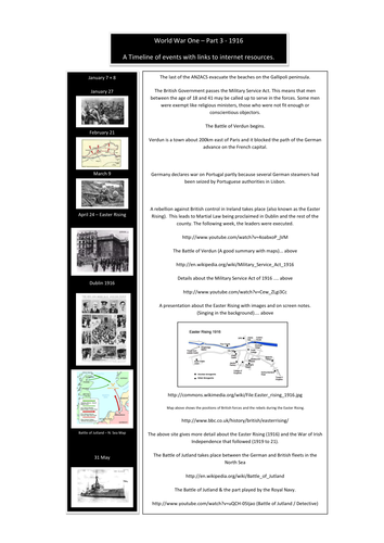
This resource can be used as a revision document or as a resource for teaching topics about WW1 during the year 1917. Resource links include: Count Von Zeppelin, Russian Revolution, Lawrence of Arabia, Battles in the Passchendaele area and tanks in use at the Battle of Cambrai. There are a number of links to web sites and video footage for delivering lessons to both KS3 and KS4 History students. Year 11 History examination students will be able to use specific sections of this folder to revise from. Note … hyperlinks have been disabled but can be easily restored.
WW1 - Timeline 1918 (Part 5)
IanPCostaDelSolIanPCostaDelSol

WW1 - Timeline 1918 (Part 5)

(0)
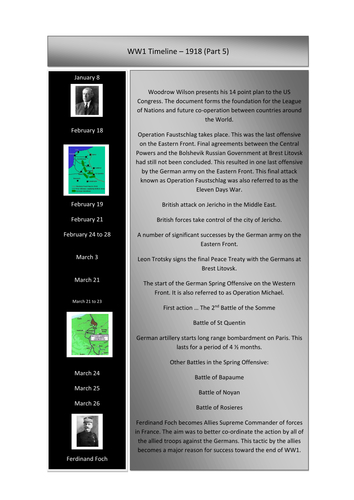
This folder can be used as a revision document or as a resource for teaching topics about WW1 from the year 1918. Resources include topics like: German Spring Offensive, 100 Days Offensive and the End of the War. There are a number of links to web sites and video footage for delivering lessons to both KS 3 and KS 4 History students. Year 11 History examination students will be able to use specific sections of this folder to revise from. Note … hyperlinks have been disabled but can be easily restored.
Adolf Hitler - 1889 to 1918 (His Early Years & WW1)
IanPCostaDelSolIanPCostaDelSol

Adolf Hitler - 1889 to 1918 (His Early Years & WW1)

(0)
Adolf Hitler 1889 to 1918 – His Early Years and WW1 - This resource comes in the form of a fact file and a selection of classroom exercises that are aimed at 13 to 16 year old students of 20th Century History. In addition to this there is a small section (images) that would be suitable for the PSHE programme especially in the month of November. The material in this 21 page resource documents the birth of Adolf Hitler through to the conclusion of WW1. It contains written information, pictures, maps, quiz questions and research challenges. The research challenges are ideal for perhaps two internet sessions where students need to search for extra information. The contents are best suited for Key Stage 3 and students in Key Stage 4 preparing for History examinations, particularly the topics “The Rise of Adolf Hitler”, “Development of a Dictatorship” and “The Events of WW1”. The resource materials offered should satisfy between 4 and 8 hours of work in the classroom. As an alternative it may also be offered as a home research project in preparation for GCSE examinations. This resource can be linked and used alongside - Adolf Hitler - Early Years (Powerpoint Presentation created by this same author).
Reign of the Tudors - A Timeline of Events.
IanPCostaDelSolIanPCostaDelSol

Reign of the Tudors - A Timeline of Events.

(0)
This resource is a Tudor timeline covering the main people and events that took place between 1485 and 1603. It is ideal for teachers delivering information about the reign of the Tudors. The resource covers a little more than 118 years of History and would be an ideal support for teachers of History in both the Primary and Secondary sectors. Included are 90 images of people, documents, castles, maps, battles and many other connected visual aids that can support the delivery of History lessons. Throughout this year (2020 - 2021) all of my resources support homeless charities and I hope that with your help we can give a few people on the streets much needed support in getting their lives back on track. Good luck in your Schools and Colleges this coming year 2020 - 2021. Ian Patterson (IanPCostaDelSol).
Salvation Army (Homeless Charity) Quiz + 10 Extra Free (Nos. 11 to 20).
IanPCostaDelSolIanPCostaDelSol

Salvation Army (Homeless Charity) Quiz + 10 Extra Free (Nos. 11 to 20).

(0)
This Salvation Army Charity Quiz targets children between the ages of 10 and 16 years but may also be suitable as a pub quiz. The Charity quiz includes general knowledge questions, pictures and a few puzzles. The file also includes 10 free general knowledge quizzes also targetting young school students. For a small donation of £2 toward the Salvation Army Homeless Charity, I hope that with your help we can make a difference to a few people who have fallen on difficult times. Perhaps some of the Primary Schools out there might consider running a Family Charity Quiz Social Evening using this resource when the World gets back to some kind of social normality. Thank you for your support. Ian Patterson (August 2020).
PTA-QUIZ NIGHT RESOURCE
IanPCostaDelSolIanPCostaDelSol

PTA-QUIZ NIGHT RESOURCE

(0)
PTA - QUIZ NIGHT RESOURCE. This resource would be ideal for an organiser of a PTA social evening and targets both the Primary and Secondary sector. In my opinion it is perfect for a family night out courtesy of the PTA. I am adding an extra resource with higher level quiz material about WW1. This includes 4 quizzes and 2 power point presentations about WW1, worth £3 in my TES Shop (Times Educational Supplement). My TES shop can be found on a TES search with “IanPCostaDelSol”. All my resources will support charity this year and beyond. In total there are at least 650 quiz questions and all with answers and fact sheets to support the content. Content includes: General knowledge, people, places, History, Geography and a host of other topics, too many to mention. The target age group was 9 to 16 but I am sure they would be ideal for a family quiz night in a school hall. More detail about the offer follows: 2020 has been a challenging year and perhaps when we get to 2021 the Schools and Colleges will get back to having social functions in support of all of the young people in the UK and around the World. This resource is everything in the way of quizzes that I have created over the last 6 months. I offered them free of charge during the Covid crisis specifically for home learning. This time I ask that you donate £2 for my Homeless Charity Appeal so that you may download this sizeable resource. My chosen charities include Crisis, Salvation Army Homeless Fund and the Berwick Project. The latter helps keep young people off the streets and gives the children much needed support, hope and ambition for their future.
Poole and Dorset - A Fieldwork Project About The Service Industry, Tourism & Other Associated Topics
IanPCostaDelSolIanPCostaDelSol

Poole and Dorset - A Fieldwork Project About The Service Industry, Tourism & Other Associated Topics

(0)
This resource is aimed at giving Geography, Travel and Tourism and Business Studies students from Years 9 through to 11 the experience of handling data related to service industries. The work serves to satisfy the type of work associated with field studies and research. The data is presented on a spreadsheet that highlights the Service Industry of Poole in Dorset. Using the information, students will be able to propose a hypothesis and then attempt to prove or refute the chosen statement. Within the folder there is a powerpoint presentation that can be used independently as a collection of Geography topics about the English County of Dorset. Specifically it addresses the concepts of Site, Situation and Function of a settlement. The powerpoint presentation alone can be used to support up to 10 contrasting lessons. The photographs can be used for introductions to a number of Human and Physical Geography topics including the following specifics and links: Poole Port, Service Industry, Tourism, Shopping Streets, Spreadsheet statistics, Bays and Headlands, Lulworth Cove, Lulworth Village, Swanage Bay, Groynes, Stair Hole, Durdle Door, Corfe Castle, Dorset Geology, Settlements, Site, Situation, Function and finally a number of excellent photographs that can be converted to field sketch diagrams.
Cities of the British Isles - Fact File Project for Geography & Information Technology
IanPCostaDelSolIanPCostaDelSol

Cities of the British Isles - Fact File Project for Geography & Information Technology

(0)
Learning at home or in the classroom - British Cities - Geography at home - Parents and teachers can easily set their children mini projects using this resource. All income on this resource will go to Homeless Charities. British Cities Fact File Challenge This project offers a research opportunity to find out more about the cities of Aberdeen, Belfast, Birmingham, Bristol, Cardiff, Dublin, Edinburgh, Glasgow, Liverpool and London. The resource is aimed at children from Years 5 to Year 9 and it provides an opportunity to combine Information Technology with Geography. It is an ideal opportunity to use a presentation to introduce the topic of British Cities. This can be extended to perhaps 4 introductory lessons with a collection of smaller challenges. After an initial introduction the students can then gather their own selected information about all ten of the cities included in the study. At the end of the project they should have a document consisting of 10 fact files and a much better knowledge of cities in both the United Kingdom and The Republic of Ireland.
Orienteering P5 & 6 - Types of Landscape & Control Descriptions.
IanPCostaDelSolIanPCostaDelSol

Orienteering P5 & 6 - Types of Landscape & Control Descriptions.

(0)
Orienteering P5 & 6 - Types of Landscape & Control Descriptions. PPP5 - The outdoor adventure sport of Orienteering makes the most of all types of landscape. This presentation explores the many types of geographical environments that have been captured on orienteering maps. The competitor in Orienteering has the opportunity to experience the following and many other varieties of landscapes: 1. Forests with many different trees. 2. Runnable woodland. 3. Thick vegetation with slow progress. 4. Farmland meadows and orchards. 5. Open parkland and scrubland. 6. Moors and land with rocky outcrops. 7. Urban landscapes with alleys, back lanes and many stairways. These can make navigation very challenging with the many twists and turns! This presentation gives you a taste of how diverse the scenery in this amazing sport can be. PPP6 - This presentation entitled “Making the most of Control Descriptions” explores the connection between the shape of the landscape and the symbolic representation of the physical features with how they appear on the map. The sport of orienteering involves visiting a number of actual locations pin-pointed on the orienteering map being used. The event organisers must prepare races for each different age group. Each set of control descriptions are set out in numerical order. The presentation starts with an experienced orienteer who explains the basics to any beginners so that they know what to expect. It also highlights how control descriptions help all orienteers to become successful. The following aspects are covered: 1. Early guidance on what to expect at your first event. 2. There are at least 8 different types of control descriptions on the guidance sheet. 3. Images and symbols are used to give a visual picture linking the landscape with the map symbols. 4. A few examples of control descriptions and map types are included. 5. The examples can be used to challenge and test the group or individual. These two presentations will help both the beginner and the intermediate to make good progress. They will soon progress to advanced levels in this incredible sport. Any income made from these two power point presentations will be donated to three different homeless charities (Crisis, Salvation Army and The Berwick Project).
Orienteering - My Journey - Ten Presentations (A coaching manual).
IanPCostaDelSolIanPCostaDelSol

Orienteering - My Journey - Ten Presentations (A coaching manual).

(0)
Orienteering - My Journey - Ten Presentations (A coaching manual). All commission from sales in this web shop will be donated to homeless charities. This resource is a collection of Power Point Presentations that highlight many of the experiences and skills that I have encountered over the past 40 years in this great outdoor sport we know as Orienteering. There are ten presentations that focus on the following key areas of this outdoor adventurous sport: The history of maps and the early days of Orienteering. A taste of Orienteering at the Malaga Orienteering Club in Spain.* Becoming familiar with an Orienteering event and what to expect. The beginner and ten things that I have found useful in Orienteering. Types of landscape and what to expect in a competition. The importance of control descriptions and making the most of what is on offer. First of two presentations about symbols. A second presentation that tests your knowledge and helps you to become familiar with map symbols. Navigation and a taste of gathering points and handrails. Contours - Understanding the rise and fall of the landscape. This resource includes a full written commentary, several videos (courtesy of Malaga Orienteering Club). The slides can be presented in either English or Spanish. Individually the presentations cost over £30. For a limited period, all ten presentations are available for half price at £15. Once again please note that all commission goes to homeless charities.
Orienteering - PPP10 The Shape of the Land & Contours.
IanPCostaDelSolIanPCostaDelSol

Orienteering - PPP10 The Shape of the Land & Contours.

(0)
Orienteering - PPP10 The Shape of the Land & Understanding the Contours. The aim of this presentation is to help the beginner and intermediate orienteer to get a mental image of the rise and fall of the landscape. In order to achieve success in this challenge, we need to understand the concept of contour lines. These brown lines on an orienteering map represents the differing levels in the landscape. In terms of altitude each line, (level on the land) could be between 2.5 and 5.0 metres apart. Contour lines close together reflect very steep slopes whereas lines wider apart would describe flat or gradually sloping land. This presentation aims to describe how the landscape can be pictured in one’s own mind thanks to the specific contour patterns shown on the maps. Some of the landscape features have specific names and shapes so they are easier to recognise and identify. Reading the contours and knowing the shapes takes the orienteer to a different level of success.
Germany 1918 to 1933-The Rise & Fall of the Weimar Republic (A 2 lesson Powerpoint Presentation)
IanPCostaDelSolIanPCostaDelSol

Germany 1918 to 1933-The Rise & Fall of the Weimar Republic (A 2 lesson Powerpoint Presentation)

(0)
This resource is a two lesson powerpoint presentation that tracks the developments of the Weimar Republic from its conception (1918) to its final demise (1933). In particular it features the political rise of Adolf Hitler from Lance Corporal to Fuhrer. It takes the form of a timeline of events and the frames can be reduced to create a pack of 48 revision cards. This presentation is ideal for students of History between the ages of 14 and 16. Frames 52 and 53 can be printed for students to compile brief notes on the two presentations. This is a quick fix exercise to help students to put the key events of the Weimar Republic into chronological order. All abilities can learn from the images and discussions inspired by this resource.
Field Sketch Library
IanPCostaDelSolIanPCostaDelSol

Field Sketch Library

(0)
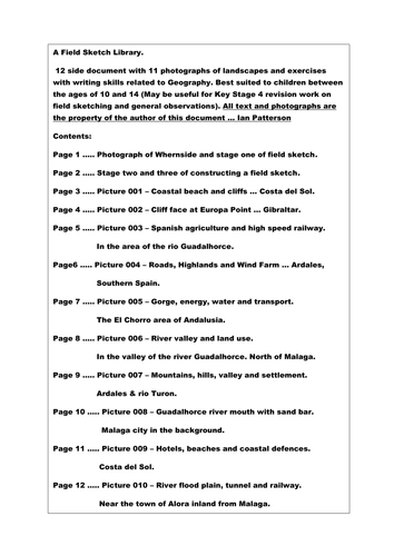
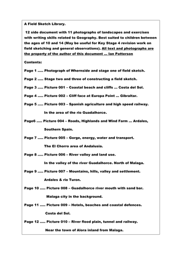
A Field Sketch Library. 12 side document with 11 photographs of landscapes and exercises with writing skills related to Geography. Best suited to children between the ages of 10 and 14 (May be useful for Key Stage 4 revision work on field sketching and landscape observations). All text, sketches and photographs the property of the author of this document … Ian Patterson
Field Sketch Library - Album 1
IanPCostaDelSolIanPCostaDelSol

Field Sketch Library - Album 1

(0)
Field sketch drawing. How to draw a field sketch + 10 extra practice photographs for students to develop their drawing and geographical knowledge. Topics include: Coastlines, beaches, cliffs, tourism, agriculture, road, rail, highlands and river valleys.