

This contains a fully resourced, differentiated lesson on the key geographical features of the British Isles. The main part of the lesson consists of a mapping task (cities and towns, seas and oceans) which is assessed through an interactive quiz included. It also includes a section on students writing a paragraph to describe the location of an English town using appropriate geographical methodology (this start with a class discussion on how this is best approached to create a list of success criteria on the board), leading to peer assessment as a plenary.
Learning Objectives:
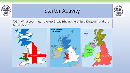
To plot the key Geographical features of the British Isles.
To describe our location using appropriate Geographical terminology.
Learning Objectives:
To plot the key Geographical features of the British Isles.
To describe our location using appropriate Geographical terminology.
Get this resource as part of a bundle and save up to 50%
A bundle is a package of resources grouped together to teach a particular topic, or a series of lessons, in one place.
Something went wrong, please try again later.
This resource hasn't been reviewed yet
To ensure quality for our reviews, only customers who have purchased this resource can review it
Report this resourceto let us know if it violates our terms and conditions.
Our customer service team will review your report and will be in touch.
£4.00