
This resource was prepared for a themed project at the end of a survival-themed learning journey. I wanted something different, maths but not the usual maths, that would continue to engage the children into that final week of term.
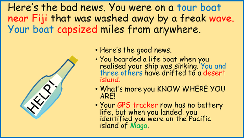
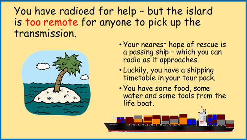
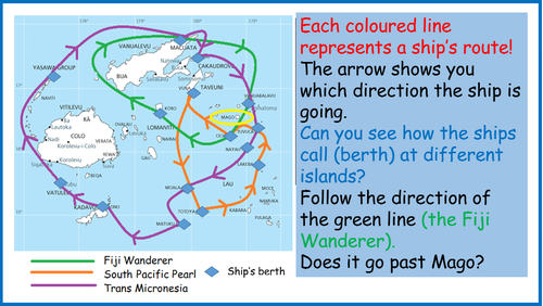
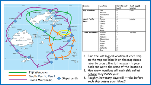
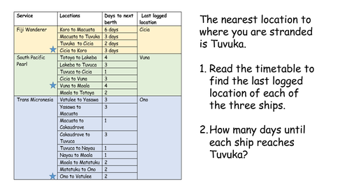
Children imagine themselves shipwrecked on a desert island, and need to be able to read the shipping map and the timetable to know when a ship will come close enough to their island to be able to pick up their radio signal for help.
This is quite different to a typical timetable reading lesson, and will need careful modelling for the pupils to experience success. ( The slides do this.) There is an alternative, more traditional timetable for LA pupils, but they may still need the help of an adult.
Print the activities directly from the power point slides. (Slides 8 and 12)
This lesson leads nicely to the second and third lessons of the project (create a look-out rota, and draw a map using coordinates in all 4 quadrants). https://www.tes.com/teaching-resource/coordinates-in-four-quadrants-desert-island-map-11866571
If you do use this resource in class, I would be really interested to hear your feedback.
Something went wrong, please try again later.
Looks great I'm going to use as part of an escape class room exercise.
Report this resourceto let us know if it violates our terms and conditions.
Our customer service team will review your report and will be in touch.
£0.00