

A complete lesson for Y3/4 to help teach atlas skills and develop pupils’ knowledge of the larger countries of Europe and their capital cities.
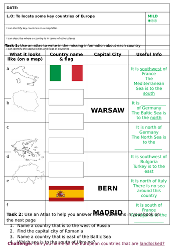
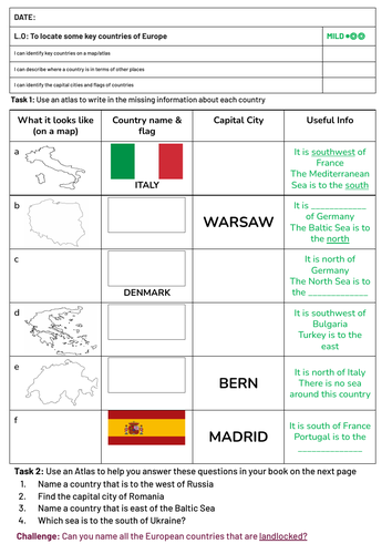
You will need a class set of atlases to teach this lesson, though there is a simple political map of Europe included with all of the key information as well. The main task is differentiated three ways, with a challenge for fast finishers.
Something went wrong, please try again later.
This resource hasn't been reviewed yet
To ensure quality for our reviews, only customers who have purchased this resource can review it
Report this resourceto let us know if it violates our terms and conditions.
Our customer service team will review your report and will be in touch.
£5.00