
Tour de France 2017 Geography is a PowerPoint presentation with information about this year's Tour,
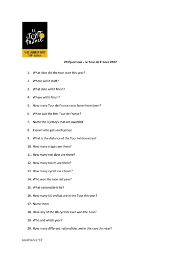
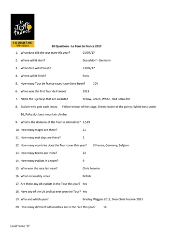
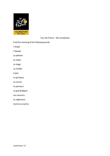
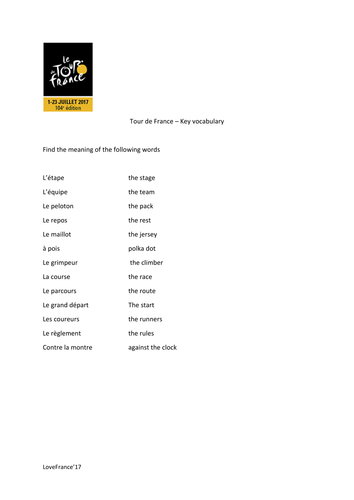
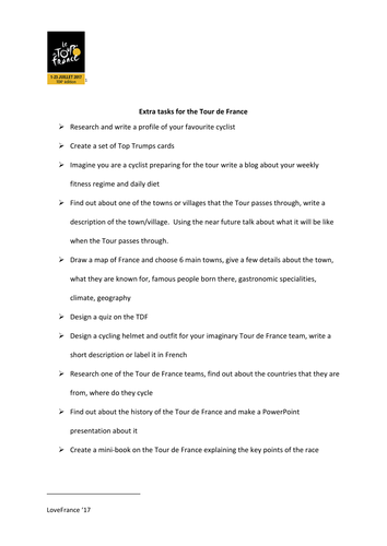
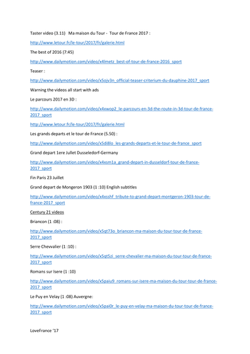
including a map of the tour and links to short video clips on various different places the Tour passes through this year. There is a set of 20 questions on the power-point, with answers, a set of Key French words with meanings and extra video links with further information surrounding the tour. I have included a list of extra tasks that you can use and develop with your class depending on time, ability and needs. This set of resources can be used with students from year 6 to year 9 or 10, I have used it with all ages and abilities and it is always an engaging topic. The tour starts on the 1st of July, I hope you enjoy it.
including a map of the tour and links to short video clips on various different places the Tour passes through this year. There is a set of 20 questions on the power-point, with answers, a set of Key French words with meanings and extra video links with further information surrounding the tour. I have included a list of extra tasks that you can use and develop with your class depending on time, ability and needs. This set of resources can be used with students from year 6 to year 9 or 10, I have used it with all ages and abilities and it is always an engaging topic. The tour starts on the 1st of July, I hope you enjoy it.
Something went wrong, please try again later.
This resource hasn't been reviewed yet
To ensure quality for our reviews, only customers who have purchased this resource can review it
Report this resourceto let us know if it violates our terms and conditions.
Our customer service team will review your report and will be in touch.
£8.00