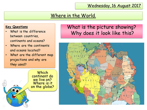

This lesson aims to get students to gain a better understanding of the continents and oceans and their location in the world. In addition to this it gets student to think about the way in which a 2D map is created and therefore the representation of continents/countries on a map. By the end of the lesson students will be able to answer the following key questions:
What is the difference between countries, continents and oceans?
Where are the continents and oceans located?
What are the different map projections and why are they used?
What is the difference between countries, continents and oceans?
Where are the continents and oceans located?
What are the different map projections and why are they used?
Get this resource as part of a bundle and save up to 67%
A bundle is a package of resources grouped together to teach a particular topic, or a series of lessons, in one place.
Something went wrong, please try again later.
This resource hasn't been reviewed yet
To ensure quality for our reviews, only customers who have purchased this resource can review it
Report this resourceto let us know if it violates our terms and conditions.
Our customer service team will review your report and will be in touch.
£2.00