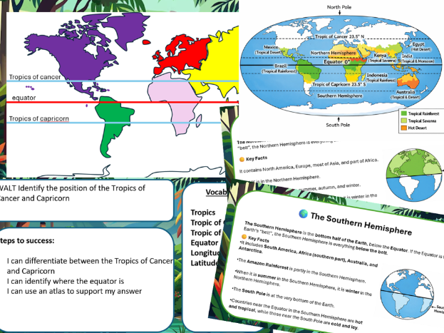

Pupils will locate and label key global lines — the Equator, Tropics of Cancer and Capricorn, Hemispheres, and Poles — and use an atlas to identify countries within the tropical zone.
They will then link these locations to climate zones using a world climate map.
Lesson Contents
Section Focus Activity / Outcome
- Starter Recap of the Equator and Hemispheres Pupils identify which hemisphere the UK is in.
- Teaching Input Introduce latitude and longitude Explain how these lines help locate places on Earth.
- Main Task Locate and label Equator, Tropics, Poles, and Hemispheres on a world map Pupils draw and label lines clearly.
- Atlas Work Use an atlas to find countries within the tropics Pupils label countries such as Brazil, Kenya, India, Indonesia, and Australia.
- Extension Identify climate zones using the world climate sheet Pupils colour or label zones (tropical rainforest, savanna, desert).
Expected Outcome
A neatly labelled world map showing:
Equator, Tropics, Hemispheres, and Poles
4–6 countries within the tropics
Climate zones colour‑coded or labelled
Something went wrong, please try again later.
This resource hasn't been reviewed yet
To ensure quality for our reviews, only customers who have purchased this resource can review it
Report this resourceto let us know if it violates our terms and conditions.
Our customer service team will review your report and will be in touch.
£2.50