Hero image

TheGeographyOasis's Shop

Average Rating4.63
(based on 37 reviews)

My aim is to create quality Geography resources for busy teachers. The worksheets are traditional and focused on key processes and knowledge. They could be used for in-class activities, flipped learning, Post class homework etc The resources focus on comprehension of key knowledge and processes. They include a mixture of activities including gap-fills, definitions, diagrams and questions. Each worksheet is supported with a PowerPoint that can be displayed in class and includes possible answers.

58Uploads

69k+Views

91k+Downloads

My aim is to create quality Geography resources for busy teachers. The worksheets are traditional and focused on key processes and knowledge. They could be used for in-class activities, flipped learning, Post class homework etc The resources focus on comprehension of key knowledge and processes. They include a mixture of activities including gap-fills, definitions, diagrams and questions. Each worksheet is supported with a PowerPoint that can be displayed in class and includes possible answers.
Volcanoes [Geography | Earth Science | Printable | Digital]
TheGeographyOasisTheGeographyOasis

Volcanoes [Geography | Earth Science | Printable | Digital]

(0)
Content: An overview of the types of volcano (active, dormant, extinct; shield, stratovolcano). Where do we find volcanoes (distribution). What causes volcanic eruptions? (Plate boundaries, hotspots) A Comparison of shield and stratovolcanoes. The common primary and secondary hazards associated with volcanic eruptions. The common social, economic, and environmental impacts of volcanic eruptions. Volcano management- Monitoring, preparing, organising. Resources are: - FACE TO FACE READY- Word Document/PDF/PowerPoint- printable resources for delivery in the classroom. - REMOTE READY- Suitable for online digital learning with links to Google Docs and Google Slides that can be directly posted onto Google Classroom. Students can use digital devices to work independently on the activities from home. Bonus Materials: Knowledge Organizer Interactive assessments (Self-marking Google Form, Keyword Quizlet, Multiple Choice Quizizz) THIS RESOURCE IS ALSO AVAILABLE AT A DISCOUNT ON THE GEOGRAPHY OASIS WEBSITE (CLICK THIS LINK) Each resource includes: Worksheet with activities. Teacher PowerPoint with diagrams and answer key provided directly onto the slides or in the notes section of each slide. - Direct link to editable Google Slides and Google Doc. Students can work on the activities remotely. Activate- a starter, an introduction, a stimulus. Content- The Geographical knowledge- supported by short activities, images, graphs, diagrams. Review- a plenary, recall activity, AFL, knowledge check. Useful links- to video clips, websites etc.
Tectonic Plate Boundaries [Geography | Earth Science | Printable | Digital]
TheGeographyOasisTheGeographyOasis

Tectonic Plate Boundaries [Geography | Earth Science | Printable | Digital]

(0)
Content: An overview of the processes and landforms at the major plate boundaries. Constructive (divergent). Destructive, Collision (convergent). Conservative (passive). High-quality diagrams, real-world examples, Structured activities. Resources are: - FACE TO FACE READY- Word Document/PDF/PowerPoint- printable resources for delivery in the classroom. - REMOTE READY- Suitable for online digital learning with links to Google Docs and Google Slides that can be directly posted onto Google Classroom. Students can use digital devices to work independently on the activities from home. Bonus Materials: Knowledge Organizer Interactive assessments (Self-marking Google Form, Keyword Quizlet, Multiple Choice Quizizz) Each resource includes: Worksheet with activities. Teacher PowerPoint with diagrams and answer key provided directly onto the slides or in the notes section of each slide. Direct link to editable Google Slides and Google Doc. Students can work on the activities remotely. Activate- a starter, an introduction, a stimulus. Content- The Geographical knowledge- supported by short activities, images, graphs, diagrams. Review- a plenary, recall activity, AFL, knowledge check. Useful links- to video clips, websites etc. What’s included: • A word document worksheet that includes activities that introduce key terminology, helps students to read graphs, describe distributions and complete structured reading activities. •The word document is 11 pages. The word document is provided in colour and grayscale. •This worksheet is also provided as a PDF. •A PowerPoint version of diagrams and answers. •The PowerPoint is 36 slides.
Layers of the Earth and the Theory of Plate Tectonics
TheGeographyOasisTheGeographyOasis

Layers of the Earth and the Theory of Plate Tectonics

(0)
Content: An overview of the characteristics of the layers of the Earth (Inner core, outer core, mantle, crust). The major tectonic plates. The distribution of earthquakes and volcanoes. Convection currents. The theory of continental drift. Resources are: FACE TO FACE READY- Word Document/PDF/PowerPoint- printable resources for delivery in the classroom. REMOTE READY- Suitable for online digital learning with links to Google Docs and Google Slides that can be directly posted onto Google Classroom. Students can use digital devices to work independently on the activities from home. Bonus Materials: Knowledge Organizer Interactive assessments (Self-marking Google Form, Keyword Quizlet, Multiple Choice Quizizz) THIS RESOURCE IS ALSO AVAILABLE AT A DISCOUNT ON THE GEOGRAPHY OASIS WEBSITE (CLICK THIS LINK) Each resource includes: Worksheet with activities. Teacher PowerPoint with diagrams and answer key provided directly onto the slides or in the notes section of each slide. Direct link to editable Google Slides and Google Doc. Students can work on the activities remotely. Activate- a starter, an introduction, a stimulus. Content- The Geographical knowledge- supported by short activities, images, graphs, diagrams. Review- a plenary, recall activity, AFL, knowledge check. Useful links- to video clips, websites etc. What’s included: • A word document worksheet that includes activities that introduce key terminology, helps students to read graphs, describe distributions and complete structured reading activities. •The word document is 8 pages. The word document is provided in colour and grayscale. •This worksheet is also provided as a PDF. •A PowerPoint version of diagrams and answers. •The PowerPoint is 25 slides.
Coastal Geography- Processes, Landforms, Management and Ecosystems
TheGeographyOasisTheGeographyOasis

Coastal Geography- Processes, Landforms, Management and Ecosystems

7 Resources
SAVE $$$ Coasts: Processes, Landforms and Management BUNDLE- Focusing on the processes that shape coastal areas (erosion, transportation,deposition), the landforms created by the processes of erosion and deposition, the impact of coastal erosion and how coastlines can be managed. Lesson 1: Ocean waves (constructive and Destructive) Lesson 2: Coastal Processes (erosion, deposition, transportation) Lesson 3: Landforms of Erosion (headlands, bays, caves, arches, stacks, stmps, wavecut platforms) Lesson 4: Landforms of deposition (Beaches, spits, bars, tombolos, sand dunes) Lesson 5: Erosion and management on the Holderness Coast Lesson 6: Mangroves **Lesson 7: ** Coral Reefs Resources are: FACE TO FACE READY- Word Document/PDF/PowerPoint- printable resources for delivery in the classroom. REMOTE READY- Suitable for online digital learning with links to Google Docs and Google Slides that can be directly posted onto Google Classroom. Students can use digital devices to work independently on the activities from home. Bonus Materials: Knowledge Organizers Interactive assessments (Self-marking Google Form, Keyword Quizlet, Multiple Choice Quizizz) THIS RESOURCE IS ALSO AVAILABLE AT A DISCOUNT ON THE GEOGRAPHY OASIS WEBSITE (CLICK THIS LINK) LINK: COASTS BUNDLE WITHOUT MANGROVES/CORAL REEFS
Population BUNDLE
TheGeographyOasisTheGeographyOasis

Population BUNDLE

9 Resources
SAVE £ £ £- Population BUNDLE- Focusing on world population growth and distribution. Case studies are used to investigate the concepts of underpopulation, overpopulation, youthful populations and aging populations. Finally, the unit explores population policies and migration World Population Growth and Population indicators The Demographic Transition Model Population Structure (Pyramids) Overpopulation in The Gambia (Youthful populations) Ageing Populations: Japan Underpopulation in Australia Population Density and Distribution Population policies (China and Singapore) International Migration (Syria to Turkey) What’s included: • 9 word document worksheets •The word documents total 46 pages. The word documents worksheets are provided in colour and grayscale. •This worksheets are also provided as PDFs. •A PowerPoint version of diagrams and answers •The PowerPoints total 147 slides.
International Migration
TheGeographyOasisTheGeographyOasis

International Migration

(0)
Content: An introduction to the different types of migration (international, internal, voluntary, forced etc.) A description of common push and pull factors. A range of data, graphs and charts that demonstrate current global patterns of migration. A detailed case study of (forced) International Migration from Syria to Turkey. Resources are: - FACE TO FACE READY- Word Document/PDF/PowerPoint- printable resources for delivery in the classroom. - REMOTE READY- Suitable for online digital learning with links to Google Docs and Google Slides that can be directly posted onto Google Classroom. Students can use digital devices to work independently on the activities from home. Bonus Materials: - Knowledge Organizer - Interactive assessments (Self-marking Google Form, Keyword Quizlet, Multiple Choice Quizizz) Each resource includes: Worksheet with activities. Teacher PowerPoint with diagrams and answer key provided directly onto the slides or in the notes section of each slide. Activate- a starter, an introduction, a stimulus. Content- The Geographical knowledge- supported by short activities, images, graphs, diagrams. Review- a plenary, recall activity, AFL, knowledge check. Useful links- to video clips, websites etc. What’s included: • A word document worksheet that includes activities that introduce key terminology, helps students to read graphs, describe distributions and complete structured reading activities. •The word document is 5 pages. The word document is provided in colour and grayscale. •This worksheet is also provided as a PDF. •A PowerPoint version of diagrams and answers. •The PowerPoint is 16 slides.
Population Policies
TheGeographyOasisTheGeographyOasis

Population Policies

(1)
Content: An introduction to the concepts of population policies, anti-natal policies and pro-natal policies. An explanation of why governments wish to influence population change. A detailed case study of China’s One Child policy (Anti-Natalist). A detailed case study of Singapore’s ‘Have three or more…’ policy (Pro-Natalist). BONUS ACTIVITY: Class debate ‘Government should never try to influence population change, it is immoral.’ To what extent do you agree? Resources are: - FACE TO FACE READY- Word Document/PDF/PowerPoint- printable resources for delivery in the classroom. - REMOTE READY- Suitable for online digital learning with links to Google Docs and Google Slides that can be directly posted onto Google Classroom. Students can use digital devices to work independently on the activities from home. Bonus Materials: - Knowledge Organizer - Interactive assessments (Self-marking Google Form, Keyword Quizlet, Multiple Choice Quizizz) Each resource includes: Worksheet with activities. Teacher PowerPoint with diagrams and answer key provided directly onto the slides or in the notes section of each slide. Activate- a starter, an introduction, a stimulus. Content- The Geographical knowledge- supported by short activities, images, graphs, diagrams. Review- a plenary, recall activity, AFL, knowledge check. Useful links- to video clips, websites etc. What’s included: • A word document worksheet that includes activities that introduce key terminology, helps students to read graphs, describe distributions and complete structured reading activities. •The word document is 6 pages. The word document is provided in colour and grayscale. •This worksheet is also provided as a PDF. •A PowerPoint version of diagrams and answers. •The PowerPoint is 23 slides.
Population Density and Distribution
TheGeographyOasisTheGeographyOasis

Population Density and Distribution

(1)
Content: An introduction to the concepts of population density, distribution, sparsely populated regions and densely populated regions. The factors that affect population density. Global distribution of population and the factors that influence this. A detailed case study of population distribution in Australia. Resources are: - FACE TO FACE READY- Word Document/PDF/PowerPoint- printable resources for delivery in the classroom. - REMOTE READY- Suitable for online digital learning with links to Google Docs and Google Slides that can be directly posted onto Google Classroom. Students can use digital devices to work independently on the activities from home. Bonus Materials: - Knowledge Organizer - Interactive assessments (Self-marking Google Form, Keyword Quizlet, Multiple Choice Quizizz) Each resource includes: Worksheet with activities. Teacher PowerPoint with diagrams and answer key provided directly onto the slides or in the notes section of each slide. Activate- a starter, an introduction, a stimulus. Content- The Geographical knowledge- supported by short activities, images, graphs, diagrams. Review- a plenary, recall activity, AFL, knowledge check. Useful links- to video clips, websites etc. What’s included: • A word document worksheet that includes activities that introduce key terminology, helps students to read graphs, describe distributions and complete structured reading activities. •The word document is 7 pages. The word document is provided in colour and grayscale. •This worksheet is also provided as a PDF. •A PowerPoint version of diagrams and answers. •The PowerPoint is 27 slides.
Underpopulation (Australia)
TheGeographyOasisTheGeographyOasis

Underpopulation (Australia)

(0)
Content: An introduction to the concepts of underpopulation, overpopulation and optimum population. A detailed case study: Is Australia underpopulated? Students are guided to prepare for and deliver a small scale debate based around Socratic questioning. Starter and plenary activities provided. Resources are: - FACE TO FACE READY- Word Document/PDF/PowerPoint- printable resources for delivery in the classroom. - REMOTE READY- Suitable for online digital learning with links to Google Docs and Google Slides that can be directly posted onto Google Classroom. Students can use digital devices to work independently on the activities from home. Bonus Materials: - Knowledge Organizer - Interactive assessments (Self-marking Google Form, Keyword Quizlet, Multiple Choice Quizizz) Each resource includes: Worksheet with activities. Teacher PowerPoint with diagrams and answer key provided directly onto the slides or in the notes section of each slide. Activate- a starter, an introduction, a stimulus. Content- The Geographical knowledge- supported by short activities, images, graphs, diagrams. Review- a plenary, recall activity, AFL, knowledge check. Useful links- to video clips, websites etc. What’s included: • A word document worksheet that includes activities that introduce key terminology, helps students to read graphs, describe distributions and complete structured reading activities. •The word document is 5 pages. The word document is provided in colour and grayscale. •This worksheet is also provided as a PDF. •A PowerPoint version of diagrams and answers. •The PowerPoint is 18 slides.
Ageing Populations: Japan
TheGeographyOasisTheGeographyOasis

Ageing Populations: Japan

(0)
Content: An introduction to the key demographic characteristics of Japan. A detailed overview of ageing population in Japan. An activity categorising the causes into reasons for falling fertility and reasons for increasing life expectancy. A reading activity to help students to identify the social, economic and political impacts. A decision-making activity focusing on possible solutions. Resources are: - FACE TO FACE READY- Word Document/PDF/PowerPoint- printable resources for delivery in the classroom. - REMOTE READY- Suitable for online digital learning with links to Google Docs and Google Slides that can be directly posted onto Google Classroom. Students can use digital devices to work independently on the activities from home. Bonus Materials: - Knowledge Organizer - Interactive assessments (Self-marking Google Form, Keyword Quizlet, Multiple Choice Quizizz) Each resource includes: Worksheet with activities. Teacher PowerPoint with diagrams and answer key provided directly onto the slides or in the notes section of each slide. Activate- a starter, an introduction, a stimulus. Content- The Geographical knowledge- supported by short activities, images, graphs, diagrams. Review- a plenary, recall activity, AFL, knowledge check. Useful links- to video clips, websites etc. What’s included: • A word document worksheet that includes activities that introduce key terminology, helps students to read graphs, describe distributions and complete structured reading activities. •The word document is 5 pages. The word document is provided in colour and grayscale. •This worksheet is also provided as a PDF. •A PowerPoint version of diagrams and answers. •The PowerPoint is 20 slides.
Overpopulation in The Gambia (Youthful Populations)
TheGeographyOasisTheGeographyOasis

Overpopulation in The Gambia (Youthful Populations)

(0)
Product Description Content: An introduction to the concepts of a youthful population, underpopulation, optimum population and overpopulation. An introduction to the key demographic characteristics of The Gambia. A detailed card sort activity that focuses on overpopulation in The Gambia (causes, impacts and solutions.) A geographical writing exercise. A board game recap activity. Resources are: - FACE TO FACE READY- Word Document/PDF/PowerPoint- printable resources for delivery in the classroom. - REMOTE READY- Suitable for online digital learning with links to Google Docs and Google Slides that can be directly posted onto Google Classroom. Students can use digital devices to work independently on the activities from home. Bonus Materials: - Knowledge Organizer - Interactive assessments (Self-marking Google Form, Keyword Quizlet, Multiple Choice Quizizz) Each resource includes: Worksheet with activities. Teacher PowerPoint with diagrams and answer key provided directly onto the slides or in the notes section of each slide. Activate- a starter, an introduction, a stimulus. Content- The Geographical knowledge- supported by short activities, images, graphs, diagrams. Review- a plenary, recall activity, AFL, knowledge check. Useful links- to video clips, websites etc. What’s included: • A word document worksheet that includes activities that introduce key terminology, helps students to read graphs, describe distributions and complete structured reading activities. •The word document is 6 pages. The word document is provided in colour and grayscale. •This worksheet is also provided as a PDF. •A PowerPoint version of diagrams and answers. •The PowerPoint is 30 slides. Product Editing Information: Can Edit: •You can edit all written passages. If you feel that the instruction or language is too simplistic or too complex then edit it to suit your learners. • I have deliberately focused on key knowledge and processes. This means that you can add around this. You can control the learning objectives, you can add video clips, your own activities etc. Use the resource as a framework. • I have found the resources easy to upload and convert to Google Slides and Google Docs Can’t Edit: •You will not be able to edit the diagrams, pictures, or visuals included in this resource.
Population Structure (Pyramids)
TheGeographyOasisTheGeographyOasis

Population Structure (Pyramids)

(0)
Content: Activities to guide students to construct and understand population pyramids. A guide to help students to describe population structure. A comparison of the population structure of countries at different levels of development. The relationship between population structure and the demographic transition model. Key terminology: Youthful population, economically active, ageing population, dependency ratio. Resources are: - FACE TO FACE READY- Word Document/PDF/PowerPoint- printable resources for delivery in the classroom. - REMOTE READY- Suitable for online digital learning with links to Google Docs and Google Slides that can be directly posted onto Google Classroom. Students can use digital devices to work independently on the activities from home. Bonus Materials: - Knowledge Organizer - Interactive assessments (Self-marking Google Form, Keyword Quizlet, Multiple Choice Quizizz) Each resource includes: Worksheet with activities. Teacher PowerPoint with diagrams and answer key provided directly onto the slides or in the notes section of each slide. Activate- a starter, an introduction, a stimulus. Content- The Geographical knowledge- supported by short activities, images, graphs, diagrams. Review- a plenary, recall activity, AFL, knowledge check. Useful links- to video clips, websites etc. What’s included: A word document worksheet that includes activities that introduce key terminology, helps students to read graphs, describe distributions and complete structured reading activities. The word document is 7 pages. The word document is provided in colour and grayscale. This worksheet is also provided as a PDF. A PowerPoint version of diagrams and answers. The PowerPoint is 24 slides
Demographic Transition Model
TheGeographyOasisTheGeographyOasis

Demographic Transition Model

(0)
Content: Activities to guide students to construct and understand the model. A living graph activity that helps students to understand the characteristics of the different stages of the model. A card sort that allows students to identify the reasons why birth rates and death rates decline in countries. An overview of the key advantages and disadvantages of the model. The resource includes 2 worksheets. One is to be used in class with the teacher and PowerPoint. The other is more structured and allows students to work independently through the activities. Resources are: - FACE TO FACE READY- Word Document/PDF/PowerPoint- printable resources for delivery in the classroom. - REMOTE READY- Suitable for online digital learning with links to Google Docs and Google Slides that can be directly posted onto Google Classroom. Students can use digital devices to work independently on the activities from home. Bonus Materials: - Knowledge Organizer - Interactive assessments (Self-marking Google Form, Keyword Quizlet, Multiple Choice Quizizz) Each resource includes: Worksheet with activities. Teacher PowerPoint with diagrams and answer key provided directly onto the slides or in the notes section of each slide. Activate- a starter, an introduction, a stimulus. Content- The Geographical knowledge- supported by short activities, images, graphs, diagrams. Review- a plenary, recall activity, AFL, knowledge check. Useful links- to video clips, websites etc. **What’s included:** • A word document worksheet that includes activities that introduce key terminology, helps students to read graphs, describe distributions and complete structured reading activities. • The word document is 6 pages. The word document is provided in colour and grayscale. • This worksheet is also provided as a PDF. • A PowerPoint version of diagrams and answers • The PowerPoint is 17 slides
World Population Growth and Population Indicators
TheGeographyOasisTheGeographyOasis

World Population Growth and Population Indicators

(1)
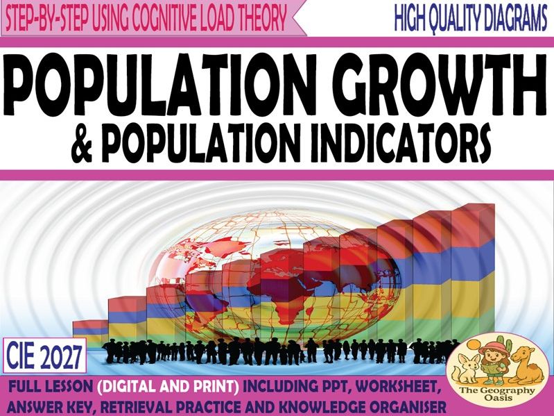
Content: Using a line graph to describe the changes to the global population from 1750-2100 (est.) Definitions of 10 key population indicators with data comparisons between Japan and The Gambia. An explanation of natural increase, net migration, and population change. Population trends and growth by region. Resources are: - FACE TO FACE READY- Word Document/PDF/PowerPoint- printable resources for delivery in the classroom. - REMOTE READY- Suitable for online digital learning with links to Google Docs and Google Slides that can be directly posted onto Google Classroom. Students can use digital devices to work independently on the activities from home. Bonus Materials: - Knowledge Organizer - Interactive assessments (Self-marking Google Form, Keyword Quizlet, Multiple Choice Quizizz) Each resource includes: Worksheet with activities. Teacher PowerPoint with diagrams and answer key provided directly onto the slides or in the notes section of each slide. Activate- a starter, an introduction, a stimulus. Content- The Geographical knowledge- supported by short activities, images, graphs, diagrams. Review- a plenary, recall activity, AFL, knowledge check. Useful links- to video clips, websites etc. THIS IS A FREE RESOURCE What’s included: • A word document worksheet that includes activities that introduce key terminology, helps students to read graphs, describe distributions and complete structured reading activities. •The word document is 6 pages. The word document is provided in colour and grayscale. •This worksheet is also provided as a PDF. •A PowerPoint version of diagrams and answers •The PowerPoint is 26 slides
Economic Development BUNDLE
TheGeographyOasisTheGeographyOasis

Economic Development BUNDLE

10 Resources
SAVE $$$ Economic Development BUNDLE- Focusing on development indicators, sectors of production, the influence of globalization and TNCs, Agriculture, Industry, Tourism, Water Scarcity and Energy that are taught through a series of contemporary case studies. Development Indicators Sectors of Production Globalsation Transnational Companies Primary Sector: Agriculture Food Shortages Secondary Sector: Industry Tertiary Sector: Tourism Water Scarcity Energy This resource focuses on economic geography. It includes diagrams, images, activities and answers. What’s included: • 10 word document worksheets •The word documents total 63 pages. The word documents worksheets are provided in colour and grayscale. •This worksheets are also provided as PDFs. •A PowerPoint version of diagrams and answers •The PowerPoints total 192 slides.
Energy Production (Iceland's Energy Mix)
TheGeographyOasisTheGeographyOasis

Energy Production (Iceland's Energy Mix)

(0)
Energy Content: The importance of Energy as a driver of economic development. Global trends and patterns of energy use. An overview of the sources of energy used by humans and their individual advantages and disadvantages. Iceland’s Energy Mix. Energy production and the environment: Kárahnjúkar dam, Iceland. Each resource includes: Worksheet with activities. Teacher PowerPoint with diagrams and answer key provided directly onto the slides or in notes section of each slide. Activate- a starter, an introduction, a stimulus. Content- The Geographical knowledge- supported by short activities, images, graphs, diagrams. Review- a plenary, recall activity, AFL, knowledge check. Useful links- to video clips, websites etc. Resources are: - FACE TO FACE READY- Word Document/PDF/PowerPoint- printable resources for delivery in the classroom. - REMOTE READY- Suitable for online digital learning with links to Google Docs and Google Slides that can be directly posted onto Google Classroom. Students can use digital devices to work independently on the activities from home. Bonus Materials: - Knowledge Organizer - Interactive assessments (Self-marking Google Form, Keyword Quizlet, Multiple Choice Quizizz) What’s included: A word document worksheet that includes activities that introduce key terminology, helps students to read graphs, describe distributions and complete structured reading activities. The word document is 11 pages. The word document is provided in colour and grayscale. This worksheet is also provided as a PDF. A PowerPoint version of diagrams and answers The PowerPoint is 30 slides Other resources from the Geography Oasis: - Development Indicators - Sectors of Production - Globalization - Transnational Companies - Primary Sector: Agriculture - Food Shortages - Secondary Sector: Industry - Tertiary Sector: Tourism - Water Scarcity
Water Scarcity
TheGeographyOasisTheGeographyOasis

Water Scarcity

(0)
Water Scarcity Content: The importance of water for humans and economic development. Water sources (aquifers, boreholes, reservoirs, desalination, infrastructure.) How countries at different levels of development use water. Global distribution of water. Areas of physical and economic water scarcity. Reasons why water is set to become more scarce in future decades. Water management- More Economically Developed Country- Singapore. Less Economically Developed Country- Ethiopia. Resources are: - FACE TO FACE READY- Word Document/PDF/PowerPoint- printable resources for delivery in the classroom. - REMOTE READY- Suitable for online digital learning with links to Google Docs and Google Slides that can be directly posted onto Google Classroom. Students can use digital devices to work independently on the activities from home. Bonus Materials: - Knowledge Organizer - Interactive assessments (Self-marking Google Form, Keyword Quizlet, Multiple Choice Quizizz) Each resource includes: Worksheet with activities. Teacher PowerPoint with diagrams and answer key provided directly onto the slides or in notes section of each slide. Activate- a starter, an introduction, a stimulus. Content- The Geographical knowledge- supported by short activities, images, graphs, diagrams. Review- a plenary, recall activity, AFL, knowledge check. Useful links- to video clips, websites etc. What’s included: A word document worksheet that includes activities that introduce key terminology, helps students to describe patterns, distributions, trends and identify impacts on real world places. The word document is 11 pages. The word document is provided in colour and grayscale. This worksheet is also provided as a PDF. A PowerPoint version of diagrams and answers The PowerPoint is 27 slides Other resources from the Geography Oasis: - Development Indicators - Sectors of Production - Globalization - Transnational Companies - Primary Sector: Agriculture - Food Shortages - Secondary Sector: Industry - Tertiary Sector: Tourism - Energy
The Growth and Impacts of Tourism
TheGeographyOasisTheGeographyOasis

The Growth and Impacts of Tourism

(0)
Content: Description of the growth of tourism globally and regionally using graphs and charts. Reasons for the growth of tourism. An introduction to sustainable tourism. Bonus Case Study: the growth of tourism and its impact in Langkawi, Malaysia. Each resource includes: Worksheet with activities. Teacher PowerPoint with diagrams and answer key provided directly onto the slides or in notes section of each slide. Activate- a starter, an introduction, a stimulus. Content- The Geographical knowledge- supported by short activities, images, graphs, diagrams. Review- a plenary, recall activity, AFL, knowledge check. Useful links- to video clips, websites etc. Resources are: - FACE TO FACE READY- Word Document/PDF/PowerPoint- printable resources for delivery in the classroom. - REMOTE READY- Suitable for online digital learning with links to Google Docs and Google Slides that can be directly posted onto Google Classroom. Students can use digital devices to work independently on the activities from home. Bonus Materials: - Knowledge Organizer - Interactive assessments (Self-marking Google Form, Keyword Quizlet, Multiple Choice Quizizz) What’s included: A word document worksheet that includes activities. The word document is 12 pages. The word document is provided in colour and grayscale. This worksheet is also provided as a PDF. A PowerPoint version of diagrams and answers The PowerPoint is 34 slides Other resources from the Geography Oasis: - Development Indicators - Sectors of Production - Globalization - Transnational Companies - Primary Sector: Agriculture - Food Shortages - Secondary Sector: Industry - Water Scarcity - Energy
Secondary Industries- Locational Factors and Industrial Systems
TheGeographyOasisTheGeographyOasis

Secondary Industries- Locational Factors and Industrial Systems

(0)
Content: Factors affecting the location of heavy industry and hi-tech industry. Case study overviews of Burnaston, UK and Cambridge Science Park, UK Industrial systems including inputs, processes and outputs. The changing location of steel works in South Wales. Each resource includes: Worksheet with activities. Teacher PowerPoint with diagrams and answer key provided directly onto the slides or in notes section of each slide. Activate- a starter, an introduction, a stimulus. Content- The Geographical knowledge- supported by short activities, images, graphs, diagrams. Review- a plenary, recall activity, AFL, knowledge check. Useful links- to video clips, websites etc. Resources are: - FACE TO FACE READY- Word Document/PDF/PowerPoint- printable resources for delivery in the classroom. - REMOTE READY- Suitable for online digital learning with links to Google Docs and Google Slides that can be directly posted onto Google Classroom. Students can use digital devices to work independently on the activities from home. Bonus Materials: - Knowledge Organizer - Interactive assessments (Self-marking Google Form, Keyword Quizlet, Multiple Choice Quizizz) What’s included: A word document worksheet that includes activities. The word document is 8 pages. The word document is provided in colour and grayscale. This worksheet is also provided as a PDF. A PowerPoint version of diagrams and answers The PowerPoint is 24 slides Other resources from the Geography Oasis: - Development Indicators - Sectors of Production - Globalization - Transnational Companies - Primary Sector: Agriculture - Food Shortages - Tertiary Sector: Tourism - Water Scarcity - Energy
Food Shortages
TheGeographyOasisTheGeographyOasis

Food Shortages

(0)
Content: The distribution of food across the globe looking at areas of undernourishment and areas of high obesity. The social, economic, environmental and political causes of food shortages. Food shortages in Somalia. Looking at the Horn of Africa Famine, 2011. (Causes, Impacts, Solutions). Includes a reading and comprehension activity. A fully resourced class debate on the causes of food shortages in Somalia. Links to solutions. Each resource includes: Worksheet with activities. Teacher PowerPoint with diagrams and answer key provided directly onto the slides or in notes section of each slide. Activate- a starter, an introduction, a stimulus. Content- The Geographical knowledge- supported by short activities, images, graphs, diagrams. Review- a plenary, recall activity, AFL, knowledge check. Useful links- to video clips, websites etc. Resources are: - FACE TO FACE READY- Word Document/PDF/PowerPoint- printable resources for delivery in the classroom. - REMOTE READY- Suitable for online digital learning with links to Google Docs and Google Slides that can be directly posted onto Google Classroom. Students can use digital devices to work independently on the activities from home. Bonus Materials: - Knowledge Organizer - Interactive assessments (Self-marking Google Form, Keyword Quizlet, Multiple Choice Quizizz) What’s included: • A word document worksheet that includes activities. •The word document is 11 pages. The word document is provided in colour and grayscale. •This worksheet is also provided as a PDF. •A PowerPoint version of diagrams and answers •The PowerPoint is 37 slides Other resources from the Geography Oasis: - Development Indicators - Sectors of Production - Globalization - Transnational Companies - Primary Sector: Agriculture - Secondary Sector: Industry - Tertiary Sector: Tourism - Water Scarcity - Energy