My shop is a non profit making concern & it supports homeless charities (Crisis, The Salvation Army & The Berwick Youth Project). Teaching has been my life & I continue to support learning around the World. My subjects were: History, Geography and Physical Education. I have competed in a wide variety of sports inc.: Gymnastics, Badminton, Rugby, Football, Athletics & many others. Check out my recent bundle with 11 of my best publications. A vast amount of support material on offer.
My shop is a non profit making concern & it supports homeless charities (Crisis, The Salvation Army & The Berwick Youth Project). Teaching has been my life & I continue to support learning around the World. My subjects were: History, Geography and Physical Education. I have competed in a wide variety of sports inc.: Gymnastics, Badminton, Rugby, Football, Athletics & many others. Check out my recent bundle with 11 of my best publications. A vast amount of support material on offer.
Another free Quiz this time it has been compiled by me, Ian Patterson (Pop). This is the fourth in a series of quiz challenges. General Knowledge Quiz prepared for my two grand-daughters Emilia and Florence. They are 9 and 11 years old. It will be suitable for children between the age of 9 and 15 years. Free to all for use as a home study exercise. Try answering them without assistance for 3 points and then receive 1 point for finding the answers using the internet or other sources. I hope you have some family fun.
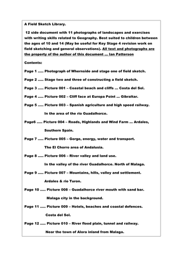
A Field Sketch Library.
12 side document with 11 photographs of landscapes and exercises with writing skills related to Geography. Best suited to children between the ages of 10 and 14 (May be useful for Key Stage 4 revision work on field sketching and landscape observations). All text, sketches and photographs the property of the author of this document … Ian Patterson
PTA - QUIZ NIGHT RESOURCE.
This resource would be ideal for an organiser of a PTA social evening and targets both the Primary and Secondary sector. In my opinion it is perfect for a family night out courtesy of the PTA. I am adding an extra resource with higher level quiz material about WW1. This includes 4 quizzes and 2 power point presentations about WW1, worth £3 in my TES Shop (Times Educational Supplement).
My TES shop can be found on a TES search with “IanPCostaDelSol”. All my resources will support charity this year and beyond.
In total there are at least 650 quiz questions and all with answers and fact sheets to support the content. Content includes: General knowledge, people, places, History, Geography and a host of other topics, too many to mention. The target age group was 9 to 16 but I am sure they would be ideal for a family quiz night in a school hall.
More detail about the offer follows:
2020 has been a challenging year and perhaps when we get to 2021 the Schools and Colleges will get back to having social functions in support of all of the young people in the UK and around the World. This resource is everything in the way of quizzes that I have created over the last 6 months. I offered them free of charge during the Covid crisis specifically for home learning. This time I ask that you donate £2 for my Homeless Charity Appeal so that you may download this sizeable resource. My chosen charities include Crisis, Salvation Army Homeless Fund and the Berwick Project. The latter helps keep young people off the streets and gives the children much needed support, hope and ambition for their future.
This Salvation Army Charity Quiz targets children between the ages of 10 and 16 years but may also be suitable as a pub quiz. The Charity quiz includes general knowledge questions, pictures and a few puzzles. The file also includes 10 free general knowledge quizzes also targetting young school students. For a small donation of £2 toward the Salvation Army Homeless Charity, I hope that with your help we can make a difference to a few people who have fallen on difficult times. Perhaps some of the Primary Schools out there might consider running a Family Charity Quiz Social Evening using this resource when the World gets back to some kind of social normality. Thank you for your support. Ian Patterson (August 2020).
A pack of 11 General Knowledge quizzes in support of the Crisis homeless charity. These quizzes are targeted at children between the ages of 9 and 16. The answer sheets act as a fact file for learning about the wider world. Please support the Crisis Charity with your £2 donation.
What would you do and who would you turn to if you found yourself homeless at this time next year?!
This resource supports three homeless charities. For only £2 you will receive a resource that highlights both Geography and History across the length and breadth of Britain. At the same time you will be helping people who find themselves on the streets and need our help to survive. The resource comes in two files. One is in Power Point format and the other is a word file that includes both a quiz challenge and an extended fact file about many different topics. These topics include: Coventry Cathedral, Edinburgh Castle and the geological feature known as a “Crag and Tail”, the Holy Island of Lindisfarne, Titanic, William Shakespeare, Isambard Kingdom Brunel, Oliver Cromwell and the “New Model Army”, Hadrian’s Wall and Features of intrusive, extrusive volcanic activity and many more.
The resource can be used for children between the ages of 10 and 16 as either a review of “The Geography and History of the British Isles” or as a Power Point quiz challenge. Many of the individual topics can be used to introduce stand alone lessons or to stimulate discussions.
This resource is a mini project about Africa. It is presented as a 25 question quiz that can be expanded for perhaps 3 to 6 lessons encompassing a wide variety of topics. The main theme of the resource targets Africa as a continent. Sub-themes (mainly Geography but also some History), includes topics such as: Biomes, Ecosystems, Climate, wildlife, River Basins, Deltas, Mountains, Natural Vegetation, Global Warming as well as several other Geographical themes.
There are many ways for delivering this material:
Each lesson can start with a question-and-answer session with the use of atlases or a projected image of Africa (The focus can be on Physical Geography, Human Geography or both.)
Focus on the first 5 questions in discussion. After 15 minutes discussion and directed teaching, Ask the children the first 5 questions as a mini challenge. As an immediate follow up show the first 5 answers from the fact file presentation. The test result is not as important as the discussion and the follow up discussion. Using this framework there is the possibility for six very contrasting lessons.
There are World map outline challenges at the end of the resource file.
Any commission from this resource will be sent to the homeless charity “CRISIS” UK.
Have fun and enjoy the teaching experience.
Orienteering - PPP10
The Shape of the Land & Understanding the Contours.
The aim of this presentation is to help the beginner and intermediate orienteer to get a mental image of the rise and fall of the landscape. In order to achieve success in this challenge, we need to understand the concept of contour lines. These brown lines on an orienteering map represents the differing levels in the landscape. In terms of altitude each line, (level on the land) could be between 2.5 and 5.0 metres apart. Contour lines close together reflect very steep slopes whereas lines wider apart would describe flat or gradually sloping land. This presentation aims to describe how the landscape can be pictured in one’s own mind thanks to the specific contour patterns shown on the maps. Some of the landscape features have specific names and shapes so they are easier to recognise and identify. Reading the contours and knowing the shapes takes the orienteer to a different level of success.
Orienteering - PPP9
Navigation, Gathering Points and Handrails.
This Power Point Presentation aims to help competitors in the art of navigation. Two ways of making the navigation challenge easier, involves making the most of gathering points and Handrails. The use of these navigation skills can help the novice to progress into an experienced, confident and successful competitor. The presentation offers the following: 1. Map examples of linear map symbols that help the runner to maintain a parallel track to the intended control point. Examples of linear features might be a) a fence, b) a wall, c) the edge of woodland. These are a few of many possibles. 2. In contrast gathering points are a number of isolated map symbols that can also help the runner to progress accurately between two control points. This is particularly useful when following a compass bearing. Isolated map features might include a) a large rock, b) a small thicket, c) an isolated tree d) a ditch running across the direction of travel, etc. There are many more examples. Long navigational legs may have as many as 5 or more gathering points. Gathering points also helps to sub-divide the leg into specific distances.
This presentation also includes a section on how to set a compass bearing using the Silva (plate) compass. As long as you have the map and compass in your hand you will not be lost! However, you may be unsure of your exact location - In these circumstances - check the orientation of the map and look for prominent physical or man made objects nearby to relocate.
Handrails and gathering points help to create bite size challenges. Learning these advanced skills help to establish stress free progress in an Orienteering event. Enjoy the challenges.
This chapter highlights the structure and content of an Orienteering Event and it is presented as a Power Point Presentation. The key elements include: The map and planning, Orienteering controls and the officials (the people behind the scenes), Preparing the maps and checking out the lay of the land, Advertising the event and taking in the entries, Setting up a suitable start and finish zone. Other interesting features include aspects of coaching, working with young competitors and also the benefits of family participation.All in all a sport with a healthy outlook and well worth trying.
This resource is part of a larger coaching document and all presentations will serve to support three homeless charities.
Home Study 2021. Improve your map skills at home. All income from this resource goes to homeless charities during 2021.
Map Skills - 50 page document with exercises and maps that can be photo-copied and re-used in different ways. Best suited to children between the ages of 10 and 14 (May be useful for Key Stage 4 revision work on map skills). All text, maps, photographs, sketches and graphics by the author … Ian Patterson
All 2021 income on this resource will go to Homeless Charities. Learn at school or at home about USA Cities.
This presentation can be used for children between the ages of 9 and sixteen. There are fifty five slides and thirty nine pages of additional resource materials. I have selected the following cities because of their contrasting site, situation and geographical locations. They are: Boston, New York, Washington DC, Chicago, Detroit, Las Vegas, Los Angeles, San Francisco and New Orleans. This selection of cities offers extended studies in both Physical and Human Geography. Included in the slide notes and the resource file are suggested work challenges involving on line work, historical links, geographical writing skills, discussions and other map drawing exercises. The presentation can be targeted at nine and ten year old students but it will be necessary to use the shortened version of the script. Children between the age of eleven and fourteen should be able to cope well with most of the challenges. Key Stage 4 (fourteen to sixteen years) students involved in examinations will be able to link this resource with a large range of the exam topics. Some examples include: Boston and New York - Settlements, site, situation and geographical location. New Orleans - Flooding, Mississippi Drainage Basin, River features including deltas. Detroit - Industrial and population change. Chicago and Detroit - Location, Waterways and Trade, Glaciation and the Great Lakes. Los Angeles and San Francisco - Environmental Hazards and Tourism. Las Vegas - Desert environment, Water resources and the Entertainment Industry. Washington DC - Capital City, history, location, population, government and tourism. There are several IT challenges on offer that involve constructing a quiz word grid, following the course of the River Colorado by using on line maps, developing knowledge of site, situation and geographical location with a starting point in Downtown Chicago. The whole project is aimed at developing a wide range of geographical knowledge along with IT skills and the opportunity to improve writing techniques in preparation for higher level studies. I personally would use this resource for Year 9 groups in preparation for Key Stage 4 Geography. The History content makes it just that little bit more interesting.
Advice and a Warning … Please note that this play makes use of sound effects like irate animals, a rather mad parrot and a deaf old lady who breaks wind!! If you use this resource, I recommend using it in the final lesson of the day. It is not for use by teachers who are faint hearted or do not have a good rapport with their students. Read on if you are interested.
This is both a short story and a short play about Diego the Parrot. The title of the play is “My Neighbour Has A Parrot”. I used to enjoy interactive lessons with my students and in partnership with my classes we used to produce plays, drama sketches and pantomimes. These were the most memorable experiences in my career as a teacher. This resource targets English and Drama or it can be used as a platform for a short stage production. Acting out plays has always been a winner for me. There are lots of sound effects included in this production and it affords the opportunity to have lots of fun with your students. As a play it would last between 10 and 15 minutes. The main characters in this production could include a narrator, old man, old lady, parrot and possibly a sound effects expert! I would target this resource at Key Stage 2 and 3 (Ages 8 to 14 year old). Initially I would read the story to the class (with the sound effects) and then develop the production as a whole class exercise and then, perhaps, in groups of between 4 and 5 children. The main aim of this classroom activity is 1) Building inner confidence and 2) Having fun in the classroom. Further developments can involve creative writing about Diego the parrot. One in particular that I have used in the past would be “Diego and the Ventriloquist”. Each child can have a go at performing and writing a small individual sketch for fun. A toy parrot strapped to the shoulder would be a useful extra. I hope you have fun with this resource.
My shop supports the Berwick Youth Project. This charity helps to keep young people safe and tries to prevent them from ending up on the streets or homeless.
**Home Studies - 2021. All income for this resource will go to homeless charities. **
I believe that this project is perfect for Key Stage 2 and 3. The children will reap the benefits in their geographical studies when they progress to examination level in Key Stage 4. The Project offers an insight into the characteristics of the Yorkshire Dales National Park and it encompasses a taste of the History and the Geography of this diverse area of Northern England. There is a mix of written material, diagrams, maps challenges and photographs. The main target area is the subject of Humanities but in particular it is best suited for studies in Geography, Travel and Tourism and some aspects of History. Throughout this resource there is an offering of tasks for students to attempt. These challenges involve discussion, descriptive and analytical writing, drawing skills, numerical assimilation and all aspects of the requirements for satisfactory coverage of the National Curriculum in the UK. Sub topics include: Glaciation, Geology, Industrial Roots, Roads and Railways, Town and Countryside, Limestone Scenery, Farming, Mapwork Skills and a few others. In total there is enough work for at least 10 lessons that will encompass the full range of geographical skills within the one project. I believe that this resource would be best suited for children between the ages of 10 and 16 years and it can be adapted for a wide range of abilities. The work offered to the children can be carried out in the classroom and some sessions could make use of the IT room in order to extend the project. I would start by using an atlas and looking at its worldwide location as part of the bigger picture and then zoom in on its site and situation within the UK National Parks organisation. At this point I would introduce the children to one of the maps on offer within the project (Page 25). From this point onward the project can make full use of the 61 page resource document. I hope you enjoy studying this wonderful part of Northern England as much as I have both on the ground and under the ground over the past 35 years.
Learning at home or in the classroom - British Cities - Geography at home - Parents and teachers can easily set their children mini projects using this resource.
All income on this resource will go to Homeless Charities.
British Cities Fact File Challenge
This project offers a research opportunity to find out more about the cities of Aberdeen, Belfast, Birmingham, Bristol, Cardiff, Dublin, Edinburgh, Glasgow, Liverpool and London.
The resource is aimed at children from Years 5 to Year 9 and it provides an opportunity to combine Information Technology with Geography. It is an ideal opportunity to use a presentation to introduce the topic of British Cities. This can be extended to perhaps 4 introductory lessons with a collection of smaller challenges. After an initial introduction the students can then gather their own selected information about all ten of the cities included in the study. At the end of the project they should have a document consisting of 10 fact files and a much better knowledge of cities in both the United Kingdom and The Republic of Ireland.
Field sketch drawing. How to draw a field sketch + 10 extra practice photographs for students to develop their drawing and geographical knowledge.
Topics include: Coastlines, beaches, cliffs, tourism, agriculture, road, rail, highlands and river valleys.
Children at Home can learn about the time line of events during WW1. Teachers can offer this resource to children who are studying WW1. Younger students may need to watch alongside their parents.
What is included … 2 Presentations, 4 Quiz Challenges and information pages.
and how to use this resource:
This resource can be used for students between the ages of 9 and 16 years.
It contains 2 power point presentations that cover the first and second half of WW1 in a chronological continuum. Each presentation has 25 slides with detailed notes included below. The commentary is most suitable for 14 to 16 year old History students but it can be easily adapted for children who are 10 to 13 years of age.
Both presentations are offered as thumbnail and note pages that can be printed and used as revision sheets for examination students who are studying WW1.
Other pages on offer include two relatively easy quiz pages with 25 questions for all age groups and two picture quizzes with ten related images (The quizzes can be attempted** with or without** the fact sheets).
Finally there is a page with 25 short writing projects that are offered as challenges for developing historical writing in preparation for examinations.
How to Use the Power Point Presentations:
Part 1 - Show as a brief introduction for various topics about WW1. The presentation can be concluded by an easy quiz (using the resource to find the answers). Testing from memory - Students can mark their own so that they can note facts and concepts that they did not learn during the presentation.
The quiz pages can act as a script for the main discussion topics whilst the presentation is being given. The second presentation can be used in the same way.
Individual slides can be used as lesson starters for initial discussion and then lead into writing challenges.
I envisage this resource being used for perhaps up to 6 lessons with 9 to 12 year old children.
Examination students might use this resource as a foundation for studying all aspects of WW1.
The picture quizzes can be used as standalone challenges using the information sheets or as an internet challenge.
Another option would be to use certain pages as Homework material.
Target groups are … GCSE History and Key Stage 2 and 3 studies.
Home Study 2020. Have you got an Atlas at home? All homes need an Atlas. This resource is ideal for doing work linked to pages from an Atlas.
All income from this resource in 2020 will go to Homeless charities.
A 268 page document with over 50 outline maps from around the World. This resource book is to be used in conjunction with a school atlas. There are a multitude of exercises and challenges for students to use as homework or in the classroom with guidance from the teacher. Also included, there are over 180 photographs from the UK and around the World that can be used individually for lesson starters or as independent slide shows.
National Curriculum, Geography - This teaching resource offers a large proportion of the main elements included in the Key Stage 1, 2, 3 and 4 specifications. Location knowledge, Place knowledge, Human and Physical Geography and also elements of fieldwork skills have been covered in many different ways.
Almost every page has a Geographical question, exercise or challenge for a wide range of ability levels. Many of the photographs could also be used in PSHE lessons or Tutor Time to inspire discussion, comments and possibly written work.
Special areas of interest: China, Spain, France, Belgium, Malaga, Palm Springs, London, Bristol, WW1 Picardie and Flanders.
This is a Power Point Presentation about Poole, Dorset and the Jurrasic Coast. Within the commentary boxes each slide offers fairly simple writing or sketching challenges for students from Year 6 through to GCSE level. The study is presented in such a way that individual students can work through each challenge from home on a PC or lap top. The geographical skills involve drawing of maps, field sketches and analytical writing that will give each student familiarity with common geographical terminology. Working for between 1 and 2 hours per day, this project should last for about 7 session but may last up to 10 one hour sessions in total. There is potential for extension work using the many images that lend themselves to field sketch drawings. This resource is offered at a minimum price of £3 and all income will be forwarded to homeless charities in 2021. It is also offered at this time especially for parents and teachers who are providing children at home with appropriate educational challenges during the Covid crisis.
This resource is a Tudor timeline covering the main people and events that took place between 1485 and 1603. It is ideal for teachers delivering information about the reign of the Tudors. The resource covers a little more than 118 years of History and would be an ideal support for teachers of History in both the Primary and Secondary sectors. Included are 90 images of people, documents, castles, maps, battles and many other connected visual aids that can support the delivery of History lessons. Throughout this year (2020 - 2021) all of my resources support homeless charities and I hope that with your help we can give a few people on the streets much needed support in getting their lives back on track. Good luck in your Schools and Colleges this coming year 2020 - 2021.
Ian Patterson (IanPCostaDelSol).