 Quick View
Tectonic Hazards: 18 Edexcel A-level Lessons
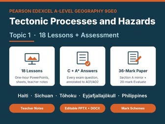
18 ready-to-teach one-hour lessons for Pearson Edexcel A-level Geography (9GE0) Topic 1: Tectonic Processes and Hazards (Paper 1, Section A): PowerPoints, two-sided resource sheets, full teacher notes, a START-HERE guide and a printed 36-mark assessment. It is a complete teaching sequence for all three enquiry questions, with a minute-by-minute timeline in every set of teacher notes.
What a lesson looks like: A five-question starter quiz retrieves earlier learning. An outcome slide sets the big question, then key words and a lesson outline. Each lesson is taught in three learning cycles: short explanation slides, a check for understanding with a reveal slide, and a practice task with a feedback slide. Every task carries an A* stretch, answered on the feedback slide. Tasks vary from lesson to lesson: calculations, block-diagram and seismogram reading, Spearman’s rank, data-reliability judgements, diamond nines, a mystery, a structured debate on the 2010 airspace closure, role cards on the Sichuan school collapses, “spot the mistakes” on the L’Aquila trial, a futures model of a Nankai Trough megaquake, and three independent research tasks (Haiti’s competing death tolls; a Philippine hazard-interaction profile; GIS risk zones with free map viewers).
Exam preparation: every lesson ends with an original exam-style question in the 9GE0 format, a levels mark scheme with AO weightings, and two full example answers, at C and A standard, annotated paragraph by paragraph against AO1, AO2 and the levels*.
The sequence: (1) where tectonic hazards occur; (2) hotspots and intra-plate earthquakes; (3) plate tectonic theory; (4) plate margins, magnitude and depth; (5) earthquake hazards: Wenchuan 2008; (6) volcanic hazards and tsunamis; (7) vulnerability and the PAR model: Haiti 2010; (8) measuring and profiling hazards; (9) impacts across development levels; (10) inequality, governance and vulnerability; (11) same magnitude, different disaster; (12) disaster trends and data reliability; (13) tectonic mega-disasters; (14) the Philippines as a multiple-hazard zone; (15) prediction, forecasting and the management cycle; (16) Park’s model, modifying the event and GIS; (17) modifying vulnerability and loss; (18) review and a printed assessment.
Before you buy: the exam-style questions are original and are not taken from Pearson papers. This resource is not endorsed by Pearson. The video slides link to IRIS/EarthScope, NOAA, PBS, Time for Geography, The B1M and YouTube, so you need internet access and a school network that allows them; please preview each clip.