Hero image

TheGeographyOasis's Shop

Average Rating4.60
(based on 36 reviews)

My aim is to create quality Geography resources for busy teachers. The worksheets are traditional and focused on key processes and knowledge. They could be used for in-class activities, flipped learning, Post class homework etc The resources focus on comprehension of key knowledge and processes. They include a mixture of activities including gap-fills, definitions, diagrams and questions. Each worksheet is supported with a PowerPoint that can be displayed in class and includes possible answers.

58Uploads

66k+Views

88k+Downloads

My aim is to create quality Geography resources for busy teachers. The worksheets are traditional and focused on key processes and knowledge. They could be used for in-class activities, flipped learning, Post class homework etc The resources focus on comprehension of key knowledge and processes. They include a mixture of activities including gap-fills, definitions, diagrams and questions. Each worksheet is supported with a PowerPoint that can be displayed in class and includes possible answers.
Population BUNDLE
TheGeographyOasisTheGeographyOasis

Population BUNDLE

9 Resources
SAVE £ £ £- Population BUNDLE- Focusing on world population growth and distribution. Case studies are used to investigate the concepts of underpopulation, overpopulation, youthful populations and aging populations. Finally, the unit explores population policies and migration World Population Growth and Population indicators The Demographic Transition Model Population Structure (Pyramids) Overpopulation in The Gambia (Youthful populations) Ageing Populations: Japan Underpopulation in Australia Population Density and Distribution Population policies (China and Singapore) International Migration (Syria to Turkey) What’s included: • 9 word document worksheets •The word documents total 46 pages. The word documents worksheets are provided in colour and grayscale. •This worksheets are also provided as PDFs. •A PowerPoint version of diagrams and answers •The PowerPoints total 147 slides.
Overpopulation in The Gambia (Youthful Populations)
TheGeographyOasisTheGeographyOasis

Overpopulation in The Gambia (Youthful Populations)

(0)
Product Description Content: An introduction to the concepts of a youthful population, underpopulation, optimum population and overpopulation. An introduction to the key demographic characteristics of The Gambia. A detailed card sort activity that focuses on overpopulation in The Gambia (causes, impacts and solutions.) A geographical writing exercise. A board game recap activity. Resources are: - FACE TO FACE READY- Word Document/PDF/PowerPoint- printable resources for delivery in the classroom. - REMOTE READY- Suitable for online digital learning with links to Google Docs and Google Slides that can be directly posted onto Google Classroom. Students can use digital devices to work independently on the activities from home. Bonus Materials: - Knowledge Organizer - Interactive assessments (Self-marking Google Form, Keyword Quizlet, Multiple Choice Quizizz) Each resource includes: Worksheet with activities. Teacher PowerPoint with diagrams and answer key provided directly onto the slides or in the notes section of each slide. Activate- a starter, an introduction, a stimulus. Content- The Geographical knowledge- supported by short activities, images, graphs, diagrams. Review- a plenary, recall activity, AFL, knowledge check. Useful links- to video clips, websites etc. What’s included: • A word document worksheet that includes activities that introduce key terminology, helps students to read graphs, describe distributions and complete structured reading activities. •The word document is 6 pages. The word document is provided in colour and grayscale. •This worksheet is also provided as a PDF. •A PowerPoint version of diagrams and answers. •The PowerPoint is 30 slides. Product Editing Information: Can Edit: •You can edit all written passages. If you feel that the instruction or language is too simplistic or too complex then edit it to suit your learners. • I have deliberately focused on key knowledge and processes. This means that you can add around this. You can control the learning objectives, you can add video clips, your own activities etc. Use the resource as a framework. • I have found the resources easy to upload and convert to Google Slides and Google Docs Can’t Edit: •You will not be able to edit the diagrams, pictures, or visuals included in this resource.
Underpopulation (Australia)
TheGeographyOasisTheGeographyOasis

Underpopulation (Australia)

(0)
Content: An introduction to the concepts of underpopulation, overpopulation and optimum population. A detailed case study: Is Australia underpopulated? Students are guided to prepare for and deliver a small scale debate based around Socratic questioning. Starter and plenary activities provided. Resources are: - FACE TO FACE READY- Word Document/PDF/PowerPoint- printable resources for delivery in the classroom. - REMOTE READY- Suitable for online digital learning with links to Google Docs and Google Slides that can be directly posted onto Google Classroom. Students can use digital devices to work independently on the activities from home. Bonus Materials: - Knowledge Organizer - Interactive assessments (Self-marking Google Form, Keyword Quizlet, Multiple Choice Quizizz) Each resource includes: Worksheet with activities. Teacher PowerPoint with diagrams and answer key provided directly onto the slides or in the notes section of each slide. Activate- a starter, an introduction, a stimulus. Content- The Geographical knowledge- supported by short activities, images, graphs, diagrams. Review- a plenary, recall activity, AFL, knowledge check. Useful links- to video clips, websites etc. What’s included: • A word document worksheet that includes activities that introduce key terminology, helps students to read graphs, describe distributions and complete structured reading activities. •The word document is 5 pages. The word document is provided in colour and grayscale. •This worksheet is also provided as a PDF. •A PowerPoint version of diagrams and answers. •The PowerPoint is 18 slides.
Coasts- Landforms of Deposition- Beaches, Spits, Bars, Tombolo, Sand Dunes
TheGeographyOasisTheGeographyOasis

Coasts- Landforms of Deposition- Beaches, Spits, Bars, Tombolo, Sand Dunes

(0)
Coastal Landforms of Deposition. Content: Describes and explains the characteristics and formation of beaches, coastal spits, coastal bars, tombolos and sand dunes. Supported by diagrams and key terminology. Application to real world examples (coastal spit). Market place group work for consolidation. Resources are: FACE TO FACE READY Word Document/PDF/PowerPoint- printable resources for delivery in the classroom. REMOTE READY Suitable for online digital learning with links to Google Docs and Google Slides that can be directly posted onto Google Classroom. Students can use digital devices to work independently on the activities from home. Bonus Materials: - Knowledge Organizer - Interactive assessments (Self-marking Google Form, Keyword Quizlet, Multiple Choice Quizizz) Each resource includes: Worksheet with activities. Teacher PowerPoint with diagrams and answer key provided directly onto the slides or in notes section of each slide. Activate- a starter, an introduction, a stimulus. Content- The Geographical knowledge- supported by short activities, images, graphs, diagrams. Review- a plenary, recall activity, AFL, knowledge check. Useful links- to video clips, websites etc. What’s included: A word document worksheet that includes step-by-step descriptions of the formation of the landform. These are supported by photographs and diagrams. The word document is 10 pages. This worksheet is also provided as a PDF. A PowerPoint version of diagrams and answers The PowerPoint is 28 slides
Coastal Geography- Processes, Landforms, Management and Ecosystems
TheGeographyOasisTheGeographyOasis

Coastal Geography- Processes, Landforms, Management and Ecosystems

7 Resources
SAVE $$$ Coasts: Processes, Landforms and Management BUNDLE- Focusing on the processes that shape coastal areas (erosion, transportation,deposition), the landforms created by the processes of erosion and deposition, the impact of coastal erosion and how coastlines can be managed. Lesson 1: Ocean waves (constructive and Destructive) Lesson 2: Coastal Processes (erosion, deposition, transportation) Lesson 3: Landforms of Erosion (headlands, bays, caves, arches, stacks, stmps, wavecut platforms) Lesson 4: Landforms of deposition (Beaches, spits, bars, tombolos, sand dunes) Lesson 5: Erosion and management on the Holderness Coast Lesson 6: Mangroves **Lesson 7: ** Coral Reefs Resources are: FACE TO FACE READY- Word Document/PDF/PowerPoint- printable resources for delivery in the classroom. REMOTE READY- Suitable for online digital learning with links to Google Docs and Google Slides that can be directly posted onto Google Classroom. Students can use digital devices to work independently on the activities from home. Bonus Materials: Knowledge Organizers Interactive assessments (Self-marking Google Form, Keyword Quizlet, Multiple Choice Quizizz) THIS RESOURCE IS ALSO AVAILABLE AT A DISCOUNT ON THE GEOGRAPHY OASIS WEBSITE (CLICK THIS LINK) LINK: COASTS BUNDLE WITHOUT MANGROVES/CORAL REEFS
Layers of the Earth and the Theory of Plate Tectonics
TheGeographyOasisTheGeographyOasis

Layers of the Earth and the Theory of Plate Tectonics

(0)
Content: An overview of the characteristics of the layers of the Earth (Inner core, outer core, mantle, crust). The major tectonic plates. The distribution of earthquakes and volcanoes. Convection currents. The theory of continental drift. Resources are: FACE TO FACE READY- Word Document/PDF/PowerPoint- printable resources for delivery in the classroom. REMOTE READY- Suitable for online digital learning with links to Google Docs and Google Slides that can be directly posted onto Google Classroom. Students can use digital devices to work independently on the activities from home. Bonus Materials: Knowledge Organizer Interactive assessments (Self-marking Google Form, Keyword Quizlet, Multiple Choice Quizizz) THIS RESOURCE IS ALSO AVAILABLE AT A DISCOUNT ON THE GEOGRAPHY OASIS WEBSITE (CLICK THIS LINK) Each resource includes: Worksheet with activities. Teacher PowerPoint with diagrams and answer key provided directly onto the slides or in the notes section of each slide. Direct link to editable Google Slides and Google Doc. Students can work on the activities remotely. Activate- a starter, an introduction, a stimulus. Content- The Geographical knowledge- supported by short activities, images, graphs, diagrams. Review- a plenary, recall activity, AFL, knowledge check. Useful links- to video clips, websites etc. What’s included: • A word document worksheet that includes activities that introduce key terminology, helps students to read graphs, describe distributions and complete structured reading activities. •The word document is 8 pages. The word document is provided in colour and grayscale. •This worksheet is also provided as a PDF. •A PowerPoint version of diagrams and answers. •The PowerPoint is 25 slides.
Volcanoes [Geography | Earth Science | Printable | Digital]
TheGeographyOasisTheGeographyOasis

Volcanoes [Geography | Earth Science | Printable | Digital]

(0)
Content: An overview of the types of volcano (active, dormant, extinct; shield, stratovolcano). Where do we find volcanoes (distribution). What causes volcanic eruptions? (Plate boundaries, hotspots) A Comparison of shield and stratovolcanoes. The common primary and secondary hazards associated with volcanic eruptions. The common social, economic, and environmental impacts of volcanic eruptions. Volcano management- Monitoring, preparing, organising. Resources are: - FACE TO FACE READY- Word Document/PDF/PowerPoint- printable resources for delivery in the classroom. - REMOTE READY- Suitable for online digital learning with links to Google Docs and Google Slides that can be directly posted onto Google Classroom. Students can use digital devices to work independently on the activities from home. Bonus Materials: Knowledge Organizer Interactive assessments (Self-marking Google Form, Keyword Quizlet, Multiple Choice Quizizz) THIS RESOURCE IS ALSO AVAILABLE AT A DISCOUNT ON THE GEOGRAPHY OASIS WEBSITE (CLICK THIS LINK) Each resource includes: Worksheet with activities. Teacher PowerPoint with diagrams and answer key provided directly onto the slides or in the notes section of each slide. - Direct link to editable Google Slides and Google Doc. Students can work on the activities remotely. Activate- a starter, an introduction, a stimulus. Content- The Geographical knowledge- supported by short activities, images, graphs, diagrams. Review- a plenary, recall activity, AFL, knowledge check. Useful links- to video clips, websites etc.
River Landforms of the Lower Course (Floodplains and Deltas)
TheGeographyOasisTheGeographyOasis

River Landforms of the Lower Course (Floodplains and Deltas)

(1)
River Landforms of the Lower Course- Focusing on Floodplains, Levees, River Deltas. Content: This resources describes and explains the formation of flood plains and river deltas. The description of each landform is supported by diagrams and key terminology. Includes application through the consideration of planning on flood plains (zonation). Introduces 3 types of river delta: cuspate, arcuate and bird’s foot. Each resource includes: Worksheet with activities. Teacher PowerPoint with diagrams and answer key provided directly onto the slides or in notes section of each slide. Activate- a starter, an introduction, a stimulus. Content- The Geographical knowledge- supported by short activities, images, graphs, diagrams. Review- a plenary, recall activity, AFL, knowledge check. Useful links- to video clips, websites etc. What’s included: A word document worksheet that includes step by step descriptions of how the landforms are created. These are supported by diagrams and follow-up questions. There is a thinking skills activity based on land use on floodplains. The word document is 5 pages. This worksheet is also provided as a PDF. A PowerPoint version of diagrams and answers The PowerPoint is 20 slides How I use this resource : In class activity- I use this resource to quickly and accurately teach the subject knowledge. I then get creative to consolidate the learning. I’ve found that the resources help to free up time for application and higher order thinking skills. Pre-class flipped learning- The majority of students should be able to access the learning in the resource without teacher support. Why not set this as pre-learning so that students can start a lesson from a position of confidence? Post class homework and consolidation- Likewise, the resources could be used to consolidate on in-class teacher instruction. To support EAL students- the resources are supported by structured sentences and key vocabulary. To support students who benefit from short, structured activities. The resource is aimed at students aged 14-16 although it could be suitable for younger/older. Product Editing Information: Can Edit: You can edit all written passages. If you feel that the instruction or language is too simplistic or too complex then edit it to suit your learners. I have deliberately focused on key knowledge and processes. This means that you can add around this. You can control the learning objectives, you can add video clips, your own activities etc. Use the resource as a framework. I have found the resources easy to upload and convert to Google Slides and Google Docs *** Can’t Edit:** You will not be able to edit the diagrams, pictures, or visuals included in this resource
Urban Problems and Solutions: Case Study Pack
TheGeographyOasisTheGeographyOasis

Urban Problems and Solutions: Case Study Pack

(0)
Urban Problems and solutions in a countries at different levels of development: Firstly, this resource provides a general overview of common problems found in cities and looks at ways in which urban planners are attempting to solve them. 3 detailed case studies are provided from countries at different levels of development: - High Income Country (UK)- LONDON- congestion, urban decline and redevelopment, decentralisation of retailing. - Middle Income Country (MALAYSIA)- KUALA LUMPUR- The positive and negative impacts of urban sprawl. - Low Income Country (INDIA)- MUMBAI- Rapid urban growth, rural to urban migration, squatter settlements. What’s included: Word document worksheets that includes activities that introduce key terminology, helps students to identify a range of urban problems/solutions, 3 distinct case study sheets focused on London, Kuala Lumpur and Mumbai. The word documents total 14 pages. The word documents are provided in colour. A PowerPoint version of diagrams and answers The PowerPoint is 60+ slides Bonus Materials: Interactive assessments (Self-marking Google Form, Keyword Quizlet, Multiple Choice Quizizz) Don’t want to purchase the full resource? CHECK OUT THE ‘MINI’ RESOURCE (Knowledge organiser and AFL activities) This resource is broken down into sections if you prefer to purchase separately: All London Case Studies- Congestion + Decline, Redevelopment + Out of town shopping Congestion in London Urban decline and regeneration in the East End of London Decentralisation of retail (Out of Town shopping centre) Urban Sprawl in Kuala Lumpur Rapid Urban Growth and Slums in Mumbai Other settlement geography resources: Settlement Patterns, Site and Function Settlement Hierarchies and Services Urban Land Use (Models) Urbanization SETTLEMENT BUNDLE
Tectonic Plate Boundaries [Geography | Earth Science | Printable | Digital]
TheGeographyOasisTheGeographyOasis

Tectonic Plate Boundaries [Geography | Earth Science | Printable | Digital]

(0)
Content: An overview of the processes and landforms at the major plate boundaries. Constructive (divergent). Destructive, Collision (convergent). Conservative (passive). High-quality diagrams, real-world examples, Structured activities. Resources are: - FACE TO FACE READY- Word Document/PDF/PowerPoint- printable resources for delivery in the classroom. - REMOTE READY- Suitable for online digital learning with links to Google Docs and Google Slides that can be directly posted onto Google Classroom. Students can use digital devices to work independently on the activities from home. Bonus Materials: Knowledge Organizer Interactive assessments (Self-marking Google Form, Keyword Quizlet, Multiple Choice Quizizz) Each resource includes: Worksheet with activities. Teacher PowerPoint with diagrams and answer key provided directly onto the slides or in the notes section of each slide. Direct link to editable Google Slides and Google Doc. Students can work on the activities remotely. Activate- a starter, an introduction, a stimulus. Content- The Geographical knowledge- supported by short activities, images, graphs, diagrams. Review- a plenary, recall activity, AFL, knowledge check. Useful links- to video clips, websites etc. What’s included: • A word document worksheet that includes activities that introduce key terminology, helps students to read graphs, describe distributions and complete structured reading activities. •The word document is 11 pages. The word document is provided in colour and grayscale. •This worksheet is also provided as a PDF. •A PowerPoint version of diagrams and answers. •The PowerPoint is 36 slides.
River Landforms of the Upper Course (Waterfalls, Rapids, Valleys, Potholes)
TheGeographyOasisTheGeographyOasis

River Landforms of the Upper Course (Waterfalls, Rapids, Valleys, Potholes)

(0)
River Landforms of the Upper Course Content: Describes the formation of V-Shaped valleys, river rapids, potholes and waterfalls. Includes step-by-step descriptions supported by diagrams and key terminology. Resources are: FACE TO FACE READY Word Document/PDF/PowerPoint- printable resources for delivery in the classroom. REMOTE READY Suitable for online digital learning with links to Google Docs and Google Slides that can be directly posted onto Google Classroom. Students can use digital devices to work independently on the activities from home. Bonus Materials: - Knowledge Organizer - Interactive assessments (Self-marking Google Form, Keyword Quizlet, Multiple Choice Quizizz) Each resource includes: Worksheet with activities. Teacher PowerPoint with diagrams and answer key provided directly onto the slides or in notes section of each slide. Activate- a starter, an introduction, a stimulus. Content- The Geographical knowledge- supported by short activities, images, graphs, diagrams. Review- a plenary, recall activity, AFL, knowledge check. Useful links- to video clips, websites etc. Don’t want to purchase the full resource? CHECK OUT THE ‘MINI’ RESOURCE (Knowledge organiser and AFL activities) What’s included: A word document worksheet that includes step by step descriptions of how the landforms are created. These are supported by diagrams. The word document is 9 pages. This worksheet is also provided as a PDF. A PowerPoint version of diagrams and answers The PowerPoint is 23 slides
The Impacts of Global Warming
TheGeographyOasisTheGeographyOasis

The Impacts of Global Warming

(0)
The Impacts of Climate Change. This resource focuses on the the social, economic and environmental impacts around the world and at a range of scales. Content: Identifies some of the social, economic and environmental impacts of the climate crisis on Asia, Europe and the United Kingdom. Considers the values and attitudes that different stakeholder may have about the likely changes brought about by climate change. Resources are: FACE TO FACE READY- Word Document/PDF/PowerPoint- printable resources for delivery in the classroom. REMOTE READY- Suitable for online digital learning with links to Google Docs and Google Slides that can be directly posted onto Google Classroom. Students can use digital devices to work independently on the activities from home. Bonus Materials: Knowledge Organizer Interactive assessments (Self-marking Google Form, Keyword Quizlet, Multiple Choice Quizizz) Each resource includes: Worksheet with activities. Teacher PowerPoint with diagrams and answer key provided directly onto the slides or in notes section of each slide. Activate- a starter, an introduction, a stimulus. Content- The Geographical knowledge- supported by short activities, images, graphs, diagrams. Review- a plenary, recall activity, AFL, knowledge check. Useful links- to video clips, websites etc. DON’T WANT TO PURCHASE THE FULL RESOURCE? CHECK OUT THIS ‘MINI’ RESOURCE (Knowledge organiser and AFL activities) What’s included: A word document worksheet that includes activities based on the impacts in Asia, Europe and the United Kingdom. Allows students to identify social, economic and environmental impacts (threats and opportunities) The word document is 5 pages. This worksheet is also provided as a PDF. A PowerPoint version of diagrams and answers The PowerPoint is 19 slides
Coastal Erosion and Management (Holderness)
TheGeographyOasisTheGeographyOasis

Coastal Erosion and Management (Holderness)

(0)
Coastal Erosion and Management Content: The factors that influence the rate of coastal erosion. A description of a range of coastal management strategies including hard and soft engineering techniques. A consideration of the positive and negative impacts of these strategies. Coastal erosion and management on the Holderness Coast. A specific focus on the village of Mappleton. A link to an interactive quiz to recap. Each resource includes: Worksheet with activities. Teacher PowerPoint with diagrams and answer key provided directly onto the slides or in notes section of each slide. Activate- a starter, an introduction, a stimulus. Content- The Geographical knowledge- supported by short activities, images, graphs, diagrams. Review- a plenary, recall activity, AFL, knowledge check. Useful links- to video clips, websites etc. What’s included: A word document worksheet that includes a comparison of two coastlines, a comprehensive overview of hard and soft coastal management strategies, a focus on erosion and management of the Holderness coast. The word document is 10 pages. This worksheet is also provided as a PDF. A PowerPoint version of diagrams and answers The PowerPoint is 29 slides How I use this resource : In class activity- I use this resource to quickly and accurately teach the subject knowledge. I then get creative to consolidate the learning. I’ve found that the resources help to free up time for application and higher order thinking skills. Pre-class flipped learning- The majority of students should be able to access the learning in the resource without teacher support. Why not set this as pre-learning so that students can start a lesson from a position of confidence? Post class homework and consolidation- Likewise, the resources could be used to consolidate on in-class teacher instruction. To support EAL students- the resources are supported by structured sentences and key vocabulary. To support students who benefit from short, structured activities. The resource is aimed at students aged 14-16 although it could be suitable for younger/older. Product Editing Information: Can Edit: You can edit all written passages. If you feel that the instruction or language is too simplistic or too complex then edit it to suit your learners. I have deliberately focused on key knowledge and processes. This means that you can add around this. You can control the learning objectives, you can add video clips, your own activities etc. Use the resource as a framework. I have found the resources easy to upload and convert to Google Slides and Google Docs *** Can’t Edit:** You will not be able to edit the diagrams, pictures, or visuals included in this resource
Global Warming Solutions
TheGeographyOasisTheGeographyOasis

Global Warming Solutions

(0)
Global Warming Solutions This resource focuses on the solutions to global warming. Content: Identifies a range of strategies that can help to mitigate or adapted to the impacts of global warming. Considers strategies at a range of scales from individual to international. Compares the UK with Mali to consider the most appropriate approach for each country. Climate Summit- Students work in groups to represent a country and prepare for and deliver a classroom debate on the issue. Resources are: FACE TO FACE READY Word Document/PDF/PowerPoint- printable resources for delivery in the classroom. REMOTE READY Suitable for online digital learning with links to Google Docs and Google Slides that can be directly posted onto Google Classroom. Students can use digital devices to work independently on the activities from home. **Bonus Materials: Knowledge Organizer** - Interactive assessments (Self-marking Google Form, Keyword Quizlet, Multiple Choice Quizizz) Each resource includes: Worksheet with activities. Teacher PowerPoint with diagrams and answer key provided directly onto the slides or in notes section of each slide. Activate- a starter, an introduction, a stimulus. Content- The Geographical knowledge- supported by short activities, images, graphs, diagrams. Review- a plenary, recall activity, AFL, knowledge check. Useful links- to video clips, websites etc. What’s included: A word document worksheet that includes activities based on 15 actions that could reduce the impact of global warming, an application task to two different countries (United Kingdom and Mali). Allows students to identify: mitigation, adaptation, individual scale, regional, national, and international The word document is 5 pages. This worksheet is also provided as a PDF. A PowerPoint version of diagrams and answers The PowerPoint is 27 slides How I use this resource :
Secondary Industries- Locational Factors and Industrial Systems
TheGeographyOasisTheGeographyOasis

Secondary Industries- Locational Factors and Industrial Systems

(0)
Content: Factors affecting the location of heavy industry and hi-tech industry. Case study overviews of Burnaston, UK and Cambridge Science Park, UK Industrial systems including inputs, processes and outputs. The changing location of steel works in South Wales. Each resource includes: Worksheet with activities. Teacher PowerPoint with diagrams and answer key provided directly onto the slides or in notes section of each slide. Activate- a starter, an introduction, a stimulus. Content- The Geographical knowledge- supported by short activities, images, graphs, diagrams. Review- a plenary, recall activity, AFL, knowledge check. Useful links- to video clips, websites etc. Resources are: - FACE TO FACE READY- Word Document/PDF/PowerPoint- printable resources for delivery in the classroom. - REMOTE READY- Suitable for online digital learning with links to Google Docs and Google Slides that can be directly posted onto Google Classroom. Students can use digital devices to work independently on the activities from home. Bonus Materials: - Knowledge Organizer - Interactive assessments (Self-marking Google Form, Keyword Quizlet, Multiple Choice Quizizz) What’s included: A word document worksheet that includes activities. The word document is 8 pages. The word document is provided in colour and grayscale. This worksheet is also provided as a PDF. A PowerPoint version of diagrams and answers The PowerPoint is 24 slides Other resources from the Geography Oasis: - Development Indicators - Sectors of Production - Globalization - Transnational Companies - Primary Sector: Agriculture - Food Shortages - Tertiary Sector: Tourism - Water Scarcity - Energy
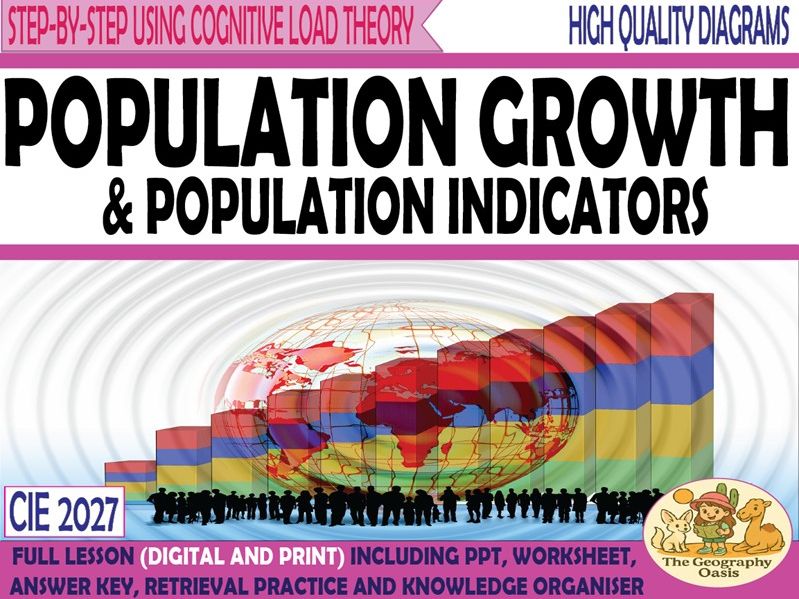
World Population Growth and Population Indicators
TheGeographyOasisTheGeographyOasis

World Population Growth and Population Indicators

(1)
Content: Using a line graph to describe the changes to the global population from 1750-2100 (est.) Definitions of 10 key population indicators with data comparisons between Japan and The Gambia. An explanation of natural increase, net migration, and population change. Population trends and growth by region. Resources are: - FACE TO FACE READY- Word Document/PDF/PowerPoint- printable resources for delivery in the classroom. - REMOTE READY- Suitable for online digital learning with links to Google Docs and Google Slides that can be directly posted onto Google Classroom. Students can use digital devices to work independently on the activities from home. Bonus Materials: - Knowledge Organizer - Interactive assessments (Self-marking Google Form, Keyword Quizlet, Multiple Choice Quizizz) Each resource includes: Worksheet with activities. Teacher PowerPoint with diagrams and answer key provided directly onto the slides or in the notes section of each slide. Activate- a starter, an introduction, a stimulus. Content- The Geographical knowledge- supported by short activities, images, graphs, diagrams. Review- a plenary, recall activity, AFL, knowledge check. Useful links- to video clips, websites etc. THIS IS A FREE RESOURCE What’s included: • A word document worksheet that includes activities that introduce key terminology, helps students to read graphs, describe distributions and complete structured reading activities. •The word document is 6 pages. The word document is provided in colour and grayscale. •This worksheet is also provided as a PDF. •A PowerPoint version of diagrams and answers •The PowerPoint is 26 slides
The Human Causes of Global Warming
TheGeographyOasisTheGeographyOasis

The Human Causes of Global Warming

(5)
The Human Causes of Climate Change This resource focuses on the the greenhouse effect and five human causes of global warming. Content: A look at the greenhouse effect at a range of scales. The macro scale factors that are increasing greenhouse gases in the atmosphere. A consideration of what/who is to blame and how these sectors may change in the future. Resources are: FACE TO FACE READY- Word Document/PDF/PowerPoint- printable resources for delivery in the classroom. REMOTE READY- Suitable for online digital learning with links to Google Docs and Google Slides that can be directly posted onto Google Classroom. Students can use digital devices to work independently on the activities from home. Bonus Materials: Knowledge Organiser Interactive assessments (Self-marking Google Form, Keyword Quizlet, Multiple Choice Quizizz) Each resource includes: Worksheet with activities. Teacher PowerPoint with diagrams and answer key directly on slides or in notes section of each slide. Activate- a starter, an introduction, a stimulus. Content- The Geographical knowledge- supported by short activities, images, graphs, diagrams. Review- a plenary, recall activity, AFL, knowledge check. Useful links- to video clips, websites etc. What’s included: A word document worksheet that includes two activities to consolidate the concept of the greenhouse effect, a reading exercise to identify the human causes of climate change, a decision making exercise on the extent that humans are to blame. The word document is 4 pages. This worksheet is also provided as a PDF. A PowerPoint version of diagrams and answers, The PowerPoint is 18 slides
River Processes- erosion, transportation and deposition.
TheGeographyOasisTheGeographyOasis

River Processes- erosion, transportation and deposition.

(5)
**River Processes: Erosion, Transportation, Deposition Content: Diagrams and definitions of the key processes of erosion: Hydraulic action, attrition, abrasion, solution. Diagrams and definitions of the key processes of transportation: traction, saltation, suspension, solution. Application to the Hjulstrom Curve. Includes games. Each resource includes: Worksheet with activities. Teacher PowerPoint with diagrams and answer key provided directly onto the slides or in notes section of each slide. Activate- a starter, an introduction, a stimulus. Content- The Geographical knowledge- supported by short activities, images, graphs, diagrams. Review- a plenary, recall activity, AFL, knowledge check. Useful links- to video clips, websites etc. Bonus Materials: Knowledge Organiser Interactive assessments (Self-marking Google Form, Keyword Quizlet, Multiple Choice Quizizz) Don’t want to purchase the full resource? CHECK OUT THE ‘MINI’ RESOURCE (Knowledge organiser and AFL activities) What’s included: A word document worksheet that includes activities based on key terminology, application of terminology to diagrams and the Hjulstrom curve. The word document is 6 pages. This worksheet is also provided as a PDF. A PowerPoint version of diagrams and answers The PowerPoint is 20 slides How I use this resource : In class activity- I use this resource to quickly and accurately teach the subject knowledge. I then get creative to consolidate the learning. I’ve found that the resources help to free up time for application and higher order thinking skills. Pre-class flipped learning- The majority of students should be able to access the learning in the resource without teacher support. Why not set this as pre-learning so that students can start a lesson from a position of confidence? Post class homework and consolidation- Likewise, the resources could be used to consolidate on in-class teacher instruction. To support EAL students- the resources are supported by structured sentences and key vocabulary. To support students who benefit from short, structured activities. The resource is aimed at students aged 14-16 although it could be suitable for younger/older. Product Editing Information: Can Edit: You can edit all written passages. If you feel that the instruction or language is too simplistic or too complex then edit it to suit your learners. I have deliberately focused on key knowledge and processes. This means that you can add around this. You can control the learning objectives, you can add video clips, your own activities etc. Use the resource as a framework. I have found the resources easy to upload and convert to Google Slides and Google Docs *** Can’t Edit:** You will not be able to edit the diagrams, pictures, or visuals included in this resource