International
Resources
Topical and themed
Pre-K and Kindergarten
Elementary
Middle school
High school
Special education
Education Jobs
Schools directory
News
Courses
Store
Resources
Education Jobs
Schools directory
News
Search
Tes for schools
Log in
Register
for free
Resources
Education Jobs
Schools directory
News
Magazine
Courses
Log out
Help
Home feed
My list
Courses
My Jobs
Job alerts
My CV
Career preferences
Resources
Author dashboard
Settings
Edit account
Log out
Home
Resources
Jobs
Schools directory
News
Magazine
Courses
Register for free
Log in
Help
Geography
Add a resource
Edit shop
Average Rating
4.55
(based on 23 reviews)
Geography
Average Rating
4.55
(based on 23 reviews)
Edit shop
Add a resource
39
Uploads
51k+
Views
9k+
Downloads
All resources
Geography
History
Whole school
More
All resources
Lowest price
Relevance
Newest
Highest rated
Lowest price
awoods24
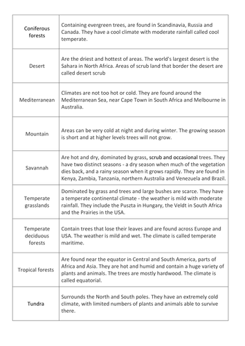
Biome Card Sort
(4)
awoods24
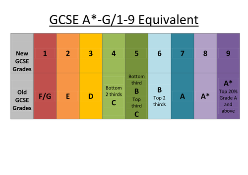
GCSE A-G 1-9 Equivalent
(1)
awoods24
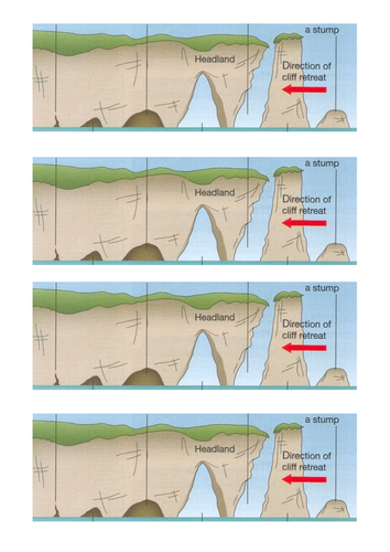
Features of Coastal Erosion
(1)
awoods24
Pakistan Floods 2010
(1)
awoods24
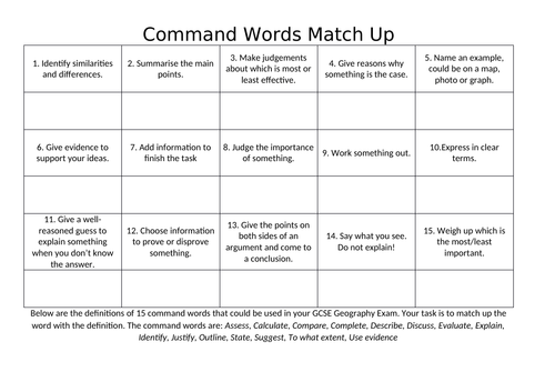
Command Word Match Up Task for AQA A GCSE Geography
(0)
awoods24
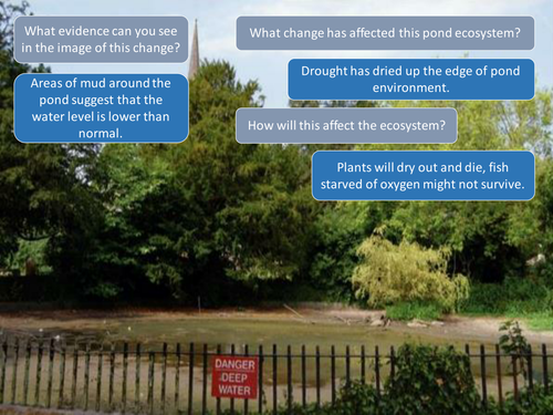
5.2 AQA How does change affect ecosystems
(0)
awoods24
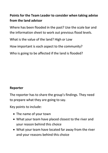
Flood Zoning Decision Making Exercise
(0)
awoods24
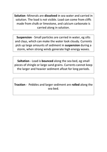
Coastal Transportation
(0)
awoods24
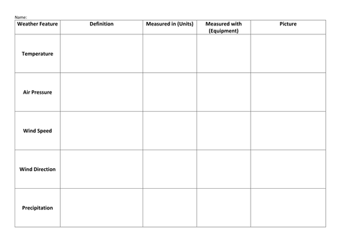
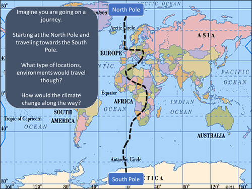
Weather and Climate and How do we measure the Weather?
(0)
awoods24
Definition Grids for AQA A Geography GCSE
(0)
awoods24
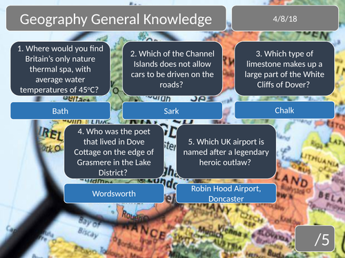
Geography General Knowledge 5 Question Quiz
(0)
awoods24
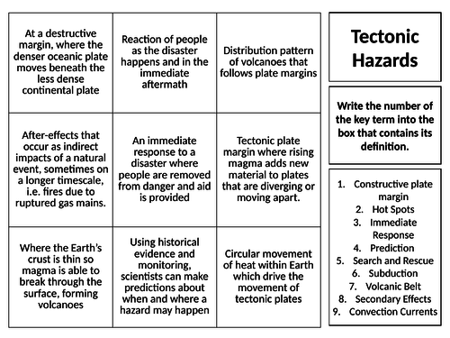
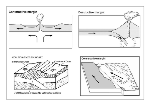
AQA A New Spec - Plate Margins
(1)
awoods24
AQA A Distribution of Ecosystems
(1)
awoods24
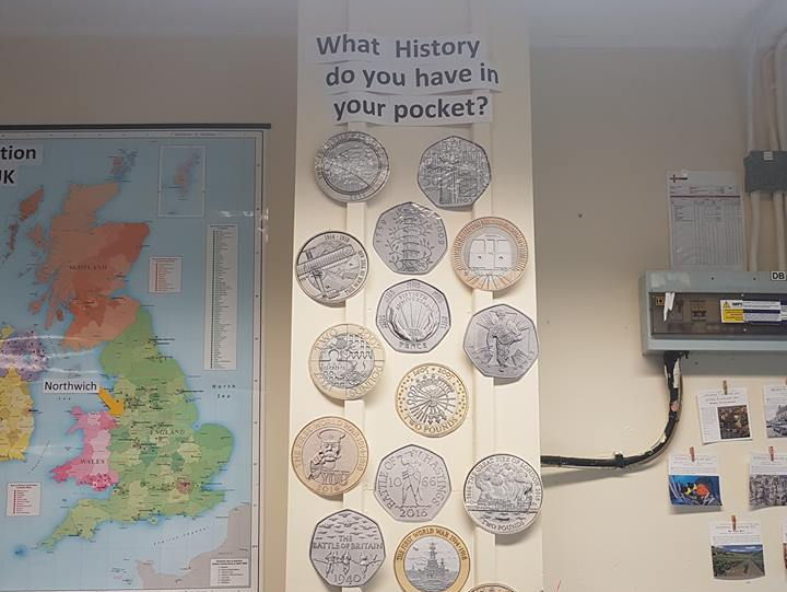
History Display - What history do you have in your pocket? Coins
(3)
awoods24
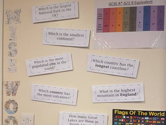
Geography Display - "Not the typical geography questions"
(1)
awoods24
Tropical Rainforests Revision Booklets AQA A Geography GCSE
(1)
awoods24
Glacial features on an OS map
(0)
awoods24
Hardest Geography Questions Geography Display
(0)
awoods24
AQA A GCSE Reducing the risk from tectonic hazards
(0)
awoods24
Country of the Month Display
(0)
Previous
1
2
Next