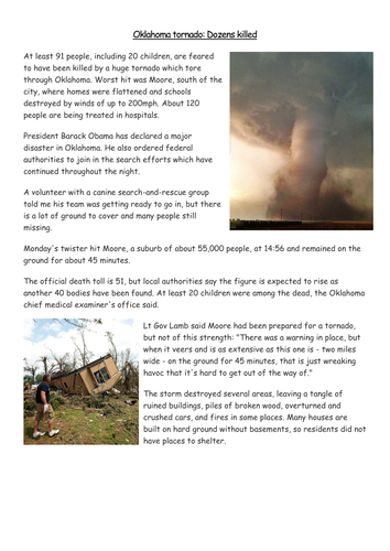
Uses photos and news reports from Oklahoma Tornado on 20th May to consider the effects of the tornado on people and the environment. Starter activity of 'reading photo&' and encouraging empathy, then DARTs (Directed Activity Related to Texts) to colourcode information to find it to answer questions. Differentiated extension; to write a diary. Planned as a standalone lesson in view of the disaster, could fit as a case study in a scheme of work on extreme weather. Please review.
2 lessons to get to grips with longshore drift. The first is an overview of how the process works, including video, then draw the process. Uses an aerial photograph of Sandbanks to extend students to see if they understand. The second lesson uses examples of Hurst Spit, Slapton Sands and Chessil Beach. Students draw how a spit is formed (SEN sheet included) and more able go onto to examine bar and tombolo annotating photos from the presentation.
Please leave a review.
Uses BBC article to encourage students to look at the drought crisis in Africa, uses images from ActionAid. Asks if the UK is doing enough and what else can/should be done.
Feedback please
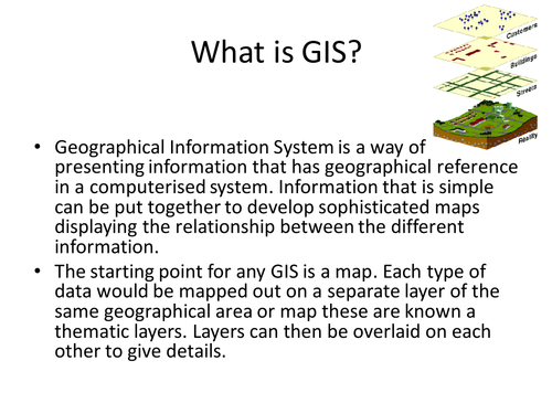
Prepared for AQA Geography B, a guide for students to use GIS to reseach Historic Hurricanes and accompanying PowerPoint. Task, for them to work in pairs to prepare a PowerPoint that uses GIS and explains why GIS is important in the preparation for Tropical Storms
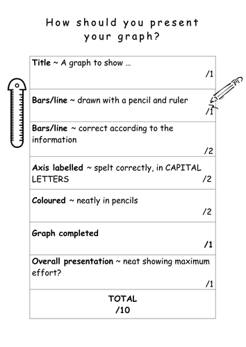
Updated crib Sheets to enable students to produce outstanding maps, graphs and fieldsketches. A 10/10 sheet to ensure they remember title, key etc. A useful reminder for students and another method for ensuring your lesson has success criteria!
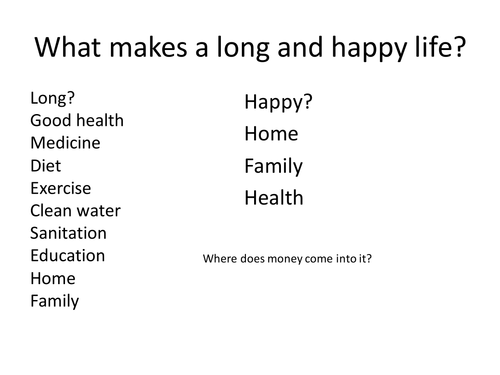
Any good atlas will have statistics in it about population, birth rate, death rate etc. Starter - what makes a long and happy life? Plenary - Play Your Life Expectancy Right - game using data on Life Expectancy, will it be Higher or Lower. My Year 8's love this!
Links with my other resources on population
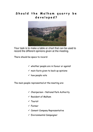
All resources for a role play about whether a limestone quarry should be developed in Malham. All roles, writing frame, sample speeches and record sheet provided. I use this as an assessment and the students really enjoy it!
Comments please
Encourages students to consider food miles and once they have gathered information, locations can be mapped and the food miles of their Christmas dinner calculated
Uses images of England to encourage students to consider what England is like, includes plenary game 'A question of England'. Worksheet uses bi-polar analysis to investigate secondary images. Constructive comments please
End of unit assessment - students choose one of six locations in Europe for a holiday. They have to plan and write a postcard to say where they chose, what the weather and climate is like, why they went there and how climate infuences what they can do. based on Geography Matters 2 assessment, having taught elements from geog.2
I plan to use AfL the next time I do this assessment.
10 photographs showing capital cities of Africa and outline maps, works well if they are laminated and cut up in envelopes. Student use a map of Africa to match cities to countries before considering whether they are rich cities, poor cities and/or attractive to tourists. Comments appreciated please.
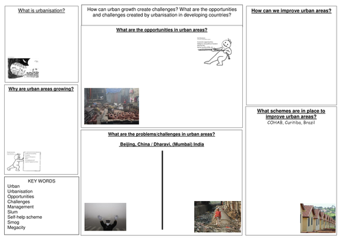
A revision booklet for Urban (Unit 1) that follows the AQA Geography B textbook. Also sheets that can be copied onto A3 for revision in class or at home.
Uses the format of a recipe to encourage children to think about what makes a perfect Christmas, includes my suggestions, but open to being extended. Surprising how many children forget Christmas is a religious festival!
Uses worldmapper to consider countries with poor sanitation and water quality. Suggest split group into two families to work out which countries/regions firstly have best sanitation and secondly poorest water quality. Makes noises like Family Fortunes,but you will need a copy of the answers for your own information.
Feedback appreciated, thank you
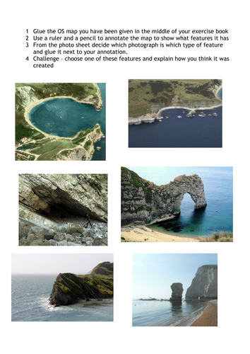
Uses an OS map of Dorset for students to locate coastal features. After watching the short video, students identify coastal features (to ensure that they know which is which there is a matching activity). Students then glue in the OS map of Lulworth Cove area and match photographs to the map. They can choose one feature and explain how it was formed as an extension. Our school is on the coast so you may need to adapt some activities to wherever you are in the country.
Please leave a review.
Uses the Top Trump format to get children to make cards about Christmas. I tend to encourage a range of secular and religious figures - and a range of categories; present giving powers, ability to fly and relevance in the Christmas story
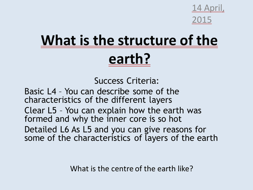
Introduction to volcanoes and earthquakes - what is the structure of the earth. Uses BBC2's How the Earth was formed and students use worksheet and instructions in presentation to make their own cross section of the earth. A very nice activity, if I do say so myself.