Hero image

Interactive Printables

Average Rating4.56
(based on 33 reviews)

Thank you for visiting! Here you will find a selection of printable, interactive worksheets for your classroom: Basic Geography worksheets with simple maps, ESL, Spanish, Bible, Reading Comprehension and more. I hope you find the resources useful! Reviews are welcome and very much appreciated. Thank you so much.

429Uploads

373k+Views

10k+Downloads

Thank you for visiting! Here you will find a selection of printable, interactive worksheets for your classroom: Basic Geography worksheets with simple maps, ESL, Spanish, Bible, Reading Comprehension and more. I hope you find the resources useful! Reviews are welcome and very much appreciated. Thank you so much.
UGANDA - Introductory Geography Worksheet
tspeelmantspeelman

UGANDA - Introductory Geography Worksheet

(1)
Introduce your students to Uganda with two worksheets (plus answer key). Your students will read a brief introduction to Uganda (location, capital, flag, language), write ‘Kampala’ next to the star on the map to show the location of the capital, color the small map, and use the map and compass to answer 8 questions on page 2. Colored pencils and a pen or pencil are needed for this activity. No other prep needed. Basic Geography worksheet with a simple map to introduce the country of Uganda and practice cardinal/ordinal directions. For use with Interactive Notebooks: After the worksheets are completed, students can cut out the map and flag and paste into the notebook under the topic of Africa / Sub-topic: Uganda. Under the map and flag, your students can write a summary in their own words of what they now know about this country. Collect worksheets for other countries of Africa to add to the notebook! Please browse this store for a selection of worksheets for other countries of Africa (and beyond!). Thank you so much for using my Geography worksheets in your classroom! I hope you find them useful. Reviews are welcome and very much appreciated!
MIDDLE EAST - FILL IN THE BLANKS
tspeelmantspeelman

MIDDLE EAST - FILL IN THE BLANKS

(0)
Using the map of the Middle East, fill in the blank letters for each of the 17 countries: Bahrain, Cyprus, Egypt, Iran, Iraq, Israel, Jordan, Kuwait, Lebanon, Oman, Palestine, Qatar, Saudi Arabia, Syria, Turkey, UAE (United Arab Emirates), Yemen. Thank you for using my printable handouts in your classroom! Please browse this store for a selection of Geography worksheets for countries of the Middle East (and beyond!).
Saint Lucia Introductory Geography Printable Worksheet with map and flag
tspeelmantspeelman

Saint Lucia Introductory Geography Printable Worksheet with map and flag

(0)
Introduce your learners to Saint Lucia with two printable worksheets (plus answer key). Simple map activity and reading comprehension questions. Your students will read a brief introduction to Saint Lucia (location, capital, flag, language), locate and circle Saint Lucia on the map of the Caribbean (map 1), write ‘Castries’ next to the star on the map of Saint Lucia (map 2) to show the location of the capital, color the map, and use the reading passage, maps and compass to answer 9 true/false questions on page 2. Colored pencils and a pen or pencil are needed for this activity. No other prep needed. Basic Geography worksheet with a simple map to introduce Saint Lucia and practice cardinal and ordinal directions. Print and Go! For use with Interactive Notebooks: After the worksheets are completed, students can cut out the map and flag and paste into the notebook under the topic of (example) The Caribbean / Sub-topic: Saint Lucia. Under the map, your students can write a summary in their own words of what they now know about this country. Collect worksheets of other countries of the Caribbean (or North America) to add to the notebook! All available in this store! Thank you so much for using my Geography worksheets in your classroom! I hope you find them useful. Reviews are welcome and very much appreciated! Please browse this store for more worksheets to introduce your learners to the countries of the world! Included: Petite Piton and Gros Piton. SPED, Resource Room Teacher, Primary school, elementary.
Africa - Continent - Printable handouts with map and list of countries
tspeelmantspeelman

Africa - Continent - Printable handouts with map and list of countries

(0)
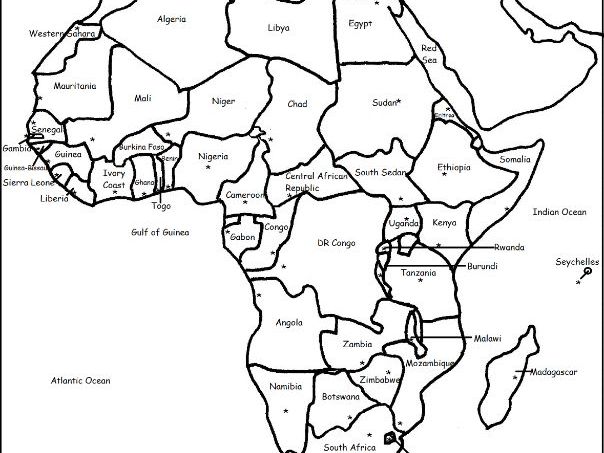
Teach your students about Africa with this packet of 7 printable worksheets. Page 1 is a list of the 54 countries of Africa in alphabetical order. Page 2 is a map of Africa. Your students will write the name of each country on the map. Page 3: Word Search: Find African countries A-L. Page 4: Word Search: Find African countries M-Z. Pages 5-6: List the 54 countries of Africa A-Z (your students will see how many they can remember on their own before referring to the list and map). Page 7: Languages of Africa. Fill in the blank. Thank you for using my Geography worksheets in your classroom!
PANAMA - Introductory Geography Worksheet
tspeelmantspeelman

PANAMA - Introductory Geography Worksheet

(1)
Introduce your learners to Panama with two printable worksheets (plus answer key). Your students will read a brief introduction to Panama (location, capital, flag, language), write ‘Panama City’ next to the star on the map to show the location of the capital, color the small flag and map, and use the map and compass to answer 10 questions on page 2. Colored pencils and a pen or pencil are needed for this activity. No other prep needed. Basic Geography worksheet with a simple map to introduce Panama and practice cardinal and ordinal directions. For use with Interactive Notebooks: After the worksheets are completed, students can cut out the map and flag and paste into the notebook under the topic of (example): Central America or Spanish-Speaking Countries / Sub-Topic: Panama. Under the map and flag, students can write a summary in their own words about what they now know about this country. Collect worksheets for other countries of Central America (or Spanish-Speaking Countries) to add to the notebook! All available in this store! Please browse this store for worksheets for countries of Central America and beyond! Thank you so much for using my Geography worksheets in your classroom! I hope you find them useful. Reviews are welcome and very much appreciated! Please browse this store for worksheets to introduce your learners to the countries of the world! Key words: Panama canal, Spanish, cardinal, ordinal directions.
CYPRUS - Introductory Geography Worksheet
tspeelmantspeelman

CYPRUS - Introductory Geography Worksheet

(0)
Introduce your learners to CYPRUS with this two printable worksheets (plus answer key). Your students will read a brief introduction to Cyprus (location, capital, flag, language), write ‘Nicosia’ next to the star on the map to show the capital, color a small map (Island of Cyprus, UN Buffer Zone, Turkish Republic of Northern Cyprus, Republic of Cyprus, Mediterranean Sea), and use the map and compass to answer 9 questions on page 2. Colored pencils and a pen or pencil are needed for this activity. No other prep needed. Basic Geography worksheet with a simple map to introduce the country of Cyprus and practice cardinal and ordinal directions. For use with Interactive Notebooks: After completing the worksheets, students can cut out the map and flag of Cyprus and paste into the notebook under the topic of Europe (or Asia or the Middle East)/Sub-Topic: Cyprus. Under the map and flag, students can write a summary in their own words of what they now know about this country. Collect worksheets for other countries of Europe, Asia, or the Middle East to add to the notebook! Please browse this store for worksheets for other countries of Europe, Asia, the Middle East (and beyond!). Thank you for using my Geography worksheets in your classroom! I hope you find them useful. Reviews are welcome and very much appreciated!
MALAWI - Introductory Geography Worksheet
tspeelmantspeelman

MALAWI - Introductory Geography Worksheet

(0)
Introduce your students to MALAWI in Africa with this printable handout of two worksheets (plus answer key). Your students will read a brief introduction to Malawi (location, capital, flag, language), write ‘Lilongwe’ next to the star on the map to show the capital, color the small map, and use the map and compass to answer 7 questions on page 2. Colored pencils and a pen or pencil are needed for this activity. No other prep needed. Basic Geography worksheet includes a simple map to introduce the country of Malawi and practice cardinal/ordinal directions. For use with Interactive Notebooks: After the worksheets are completed, students can cut out the map and flag and paste into the notebook under the topic of Africa/Sub-topic: Malawi. Under the map and flag, your students can write a summary in their own words of what they now know about this country. Collect worksheets for other countries of Africa to add to the notebook! Please browse this store for a selection of printable worksheets for other countries of Africa (and beyond!). Thank you so much for using my Geography worksheets in your classroom! I hope you find them useful. Reviews are welcome and very much appreciated!
NUMBERS BY 10 IN SPANISH - Word Search Puzzle
tspeelmantspeelman

NUMBERS BY 10 IN SPANISH - Word Search Puzzle

(0)
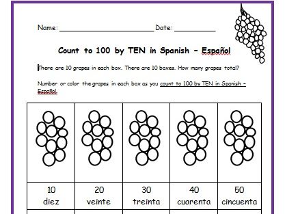
Find the Spanish words for numbers 10, 20, 30, 40, 50, 60, 70, 80, 90, 100 in the Word Search Puzzle! Included: DIEZ, VEINTE, TREINTA, CUARENTA, CINCUENTA, SESENTA, SETENTA, OCHENTA, NOVENTA, CIEN. Thank you so much for using my Spanish handouts in your classroom! Please browse this store for other worksheets for Spanish language learners.
Washington D.C. - Introductory Geography Worksheet
tspeelmantspeelman

Washington D.C. - Introductory Geography Worksheet

(0)
Introduce your learners to Washington D.C. - the capital of the United States of America, with this printable handout of two worksheets (plus answer key). Your students will read a brief overview of Washington D.C., write ‘White House’ next to the star on the map to show the location of the White House, color the small map, and answer 8 True/False questions on page 2. Colored pencils and a pen or pencil are needed for this activity. No other prep needed. Basic Geography worksheet with a simple map to introduce Washington D.C. For use with Interactive Notebooks: After the worksheets are completed, students can cut out the map and flag of Washington D.C. and paste into the notebook under the topic of United States / Sub-Topic: Washington D.C… Under the map, students can write a summary in their own words of what they now know about Washington D.C. Collect worksheets for all U.S. states to add to notebook! Please browse this store for a selection of printable Geography worksheets for all states of the USA (and beyond!). Thank you so much for using my Geography worksheets in your classroom! I hope you find them useful. Reviews are welcome and very much appreciated. District of Colombia, Potomac River, Virginia, Maryland. State Bird and State Flower. Wood Thrush. American Beauty Rose
GERMANY - States and Capital Cities
tspeelmantspeelman

GERMANY - States and Capital Cities

(0)
Introduce your students to the 16 states and capital cities of Germany with three worksheets (plus answer key). Using the list of states and capitals on page 2, your students will write the capital city of each state on the map of Germany (page 1). Then answer 8 true/false questions on page 3. States - Capitals included: Baden-Württemberg - Stuttgart Bavaria - Munich Berlin - Berlin Brandenburg - Potsdam Bremen - Bremen Hamburg - Hamburg Hesse - Wiesbaden Lower Saxony - Hanover Mecklenburg-Vorpommern - Shwerin North Rhine-Westphalia - Düsseldorf Rhineland-Palatinate - Mainz Saarland - Saarbrücken Saxony - Dresden Saxony-Anhalt - Magdeburg Schleswig-Holstein - Kiel Thuringia - Erfurt Thank you so much for using my worksheets in your classroom! I hope you find them useful. Reviews are welcome and very much appreciated. Please browse this store for more Geography worksheets!
Tales of a Fourth Grade Nothing by Judy Blume Printable worksheets for each chapter
tspeelmantspeelman

Tales of a Fourth Grade Nothing by Judy Blume Printable worksheets for each chapter

(0)
This packet includes a worksheet for each chapter of ‘Tales of a Fourth Grade Nothing’ by Judy Blume. After reading each chapter, readers can complete the worksheet/s for that chapter. Includes word search puzzles, fill-in-the-blanks, matching activities, sequencing and crosswords for reading comprehension and vocabulary building. 17 pages. Answer Key included. Worksheets are black and white (with small pictures to color as an option). Thank you for using this pack of worksheets! I hope you find them useful! Reviews are welcome and very much appreciated. If you are continuing with the Fudge series, printable worksheets for each chapter of Fudge-A-Mania are also available! Thank you again.
South America Word Search Puzzle
tspeelmantspeelman

South America Word Search Puzzle

(0)
Find each country of South America (and two dependent territories) in the Word Search Puzzle. They can be found forward or backward. Then write the remaining letters on the lines below for two facts about South America. Argentina, Bolivia, Brazil, Chile, Colombia, Ecuador, Guyana, Paraguay, Peru, Suriname, Uruguay, Venezuela, and dependent territories French Guiana and Falkland Islands. Remaining letters will spell out: The largest country in South America is Brazil. The smallest country in South America is Suriname. 1 printable handout plus answer key. Thank you!!
Colombia Map and Flag - Fill in the blanks
tspeelmantspeelman

Colombia Map and Flag - Fill in the blanks

(0)
This printable handout of 2 pages (plus answer key) includes a map and flag of Colombia. Your students will fill in the blanks for each Colombia and surrounding countries (Venezuela, Brazil, Peru, Ecuador, and Panama) and the Atlantic and Pacific Ocean, write Bogotá next to the star on the map to show the capital of Colombia, color the flag and map, and then use the map and compass to answer 7 questions.
GERMANY - Introductory Geography Worksheet with map and flag
tspeelmantspeelman

GERMANY - Introductory Geography Worksheet with map and flag

(0)
Introduce your students to Germany with this printable handout of 2 worksheets (plus answer key). Your students will read a brief introduction to Germany (location, capital, flag), write ‘Berlin’ next to the star on the map to show the location of the capital, color the small flag and map, and use the map and compass to answer 7 questions on page 2. Colored pencils and a pen or pencil are needed for this activity. No other prep needed. Basic Geography worksheet with a simple map to introduce Germany and practice cardinal and ordinal directions. For use with Interactive Notebooks: After the worksheets for Germany are completed, students can cut out the map and flag and paste into the notebook under the topic of Europe/Sub-Topic: Germany. Under the map, your students can write a summary in their own words of what they now know about Germany. Collect worksheets for other countries of Europe to add to the notebook! Please browse this store for worksheets for other countries of Europe (and beyond!). Thank you so much for using my Geography worksheets in your classroom to introduce your students to the countries of the world! I hope you find them useful and fun. Reviews are welcome and very much appreciated. Included on map: Poland, Czech Republic, Austria, France, Luxembourg, Belgium, Netherlands, North Sea.
Spanish Pronunciation Quick Guide - Printable Handout
tspeelmantspeelman

Spanish Pronunciation Quick Guide - Printable Handout

(1)
This printable handout includes a Spanish Pronunciation Quick Guide for vowels and consonants with 5 words and pictures to practice. Directions: Use the Spanish Pronunciation Guide on the left to pronounce the words on the right. Words/Pictures included in Spanish: chicken - la gallina frog - la rana carrot - la zanahoria hammer - el martillo bathtub - la bañera This is a great activity to prepare your students to increase their Spanish vocabulary. From here, your students can begin creating their own Spanish Picture Dictionary and continue to expand vocabulary with use of this pronunciation guide. For more information, please visit ‘My Spanish Picture Dictionary’ https://www.tes.com/teaching-resource/my-spanish-picture-dictionary-11829384 in my shop. Thank you so much!!
RUSSIA - Introductory Geography Worksheet
tspeelmantspeelman

RUSSIA - Introductory Geography Worksheet

(0)
Introduce your learners to RUSSIA with this printable handout of two worksheets (plus answer key). Your students will read a brief introduction to Russia (location, capital, flag), write ‘Moscow’ next to the star on the map to show the location of the capital, color the small map and flag, and use the map and compass to answer 9 questions on page 2. Colored pencils a pen or pencil are needed for this activity. No other prep needed. Basic Geography worksheet with a simple map to introduce Russia and practice cardinal and ordinal directions. For use with Interactive Notebooks: After the worksheets are completed, students can cut out the map and flag and paste it into the notebook under the topic of Europe, Asia, or Eurasia/Sub-Topic: Russia. Under the map and flag, students can write a summary in their own words of what they now know about this country. Collect worksheets for other countries of Europe or Asia to add to the notebook! Please browse this store for a selection of Geography worksheets for countries of Europe, Asia (and beyond!). Thank you so much for using my Geography worksheets in your classroom! I hope you find them useful. Reviews are welcome and very much appreciated! Please browse this store for a selection of worksheets to introduce your learners to the countries of the world!
New York - Introductory Geography Worksheet
tspeelmantspeelman

New York - Introductory Geography Worksheet

(0)
Introduce your students to the state of New York with two worksheets (plus answer key). Your students will read a brief introduction to New York (location, capital, state flag, state bird, state flower), write ‘Albany’ next to the star on the map to show the location of the capital, color the small map, state bird and flower, and use the map and compass to answer 8 questions on page 2. Colored pencils and a pen or pencil are needed for this activity. No other prep needed. Basic Geography worksheet with a simple map to introduce New York and practice cardinal and ordinal directions. For use with Interactive Notebooks: After the worksheets are completed, students can cut out the map, flag, state bird and flower, and paste it into the notebook under the topic of United States/Sub-Topic New York. Under the map, students can write a summary in their own words of what they now know about this state. Collect worksheets for other states of the USA to add to the notebook! Please browse this store for a selection of worksheets for other states of the USA (and beyond!) Thank you so much for using my worksheets in your classroom! Reviews are welcome and very much appreciated.
CUBA - Introductory Geography Worksheet
tspeelmantspeelman

CUBA - Introductory Geography Worksheet

(2)
Introduce your learners to Cuba with this printable handout of 2 worksheets (plus answer key). Your students will read a brief introduction to Cuba (location, capital, flag), write ‘Havana’ next to the star on the map to show the location of the capital, color color the flag and map of Cuba, then use the map and compass to answer 5 multiple-choice questions on page 2. Colored pencils and a pen or pencil are needed for this activity. No other prep needed. Basic Geography worksheet with a simple map to introduce Cuba and practice cardinal and ordinal directions. For use with Interactive Notebooks: After the worksheets are completed, students can cut out the map and flag and paste into the notebook under the topic of Caribbean / Sub-topic: CUBA. Under the map, your students can write a summary in their own words of what they now know about Cuba. Collect worksheets for other countries to add to the notebook! Please browse this store for a selection of worksheets for other countries of the Caribbean (and beyond!). Thank you so much for using my Geography worksheets in your classroom! I hope you find them useful. Reviews are welcome and very much appreciated! Cuba and surrounding: Jamaica, Haiti, Dominican Republic, Mexico, Belize, Guatemala, Honduras, United States, Florida, the Bahamas, Caribbean Sea, Atlantic Ocean, Gulf of Mexico. North America, Central America. Cardinal, ordinal directions. Isla de la Juventud. Note: This handout is in American English. For British English, please visit this link: https://www.tes.com/teaching-resource/cuba-printable-handout-british-english-11997673
CHINA - Introductory Geography Worksheet
tspeelmantspeelman

CHINA - Introductory Geography Worksheet

(0)
Introduce your learners to CHINA with this printable handout of two worksheets (plus answer key). Your students will read a brief introduction to China (location, capital, language, flag), write ‘Beijing’ next to the star on the map to show the location of the capital, color the flag and map, and use the map and compass to answer 10 questions on page 2. Colored pencils and a pen or pencil are needed for this activity. No other prep needed. Basic Geography worksheet with a simple map to introduce China and practice cardinal/ordinal directions. For use with Interactive Notebooks: After your students complete the worksheets, they can cut out the map and paste into the notebook under the topic Asia/Sub-topic: China. Under the map, your students can write a summary in their own words of what they now know about China. Collect worksheets for other countries of Asia to add to the notebook! Please browse this store for a selection of printable Geography worksheets for other countries of Asia (and beyond!). Thank you so much for using my Geography worksheets in your classroom! I hope you find them useful! Reviews are welcome and very much appreciated. Notes: China shares land borders with 14 countries: Vietnam, Laos, Myanmar, India, Bhutan, Nepal, Afghanistan, Pakistan, Tajikistan, Kyrgyzstan, Kazakhstan, Russia, Mongolia, and North Korea. Pacific Ocean.
Cloze Activity Verbs Past-Tense
tspeelmantspeelman

Cloze Activity Verbs Past-Tense

(1)
Printable Handout (1 page plus answer key) ‘A Summer Day at the Beach.’ Students will fill in the blanks using the word bank of past-tense verbs: parked, swam, collected, drove, decided, watched, walked, sat, read, ate, packed, carried. Cloze activity for ESL, EFL, ELL, ESOL. Vocabulary building, Reading Comprehension, Grammar.